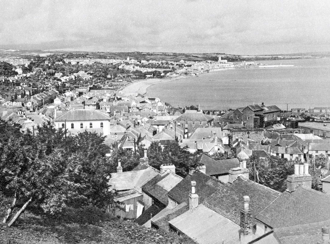
Cambridge University
The University of Cambridge has 31 colleges, of which the oldest was founded in 1284.
The newest college of the university was founded in 2010.
There are also several theological colleges which are not part of the university , but are associated with it.
The newest college of the university was founded in 2010.
There are also several theological colleges which are not part of the university , but are associated with it.
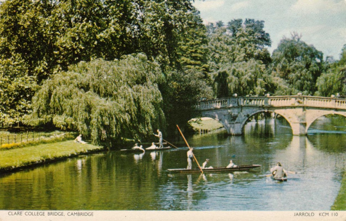
Clare College was founded in 1326, making it the second-oldest surviving college of the University after Peterhouse.
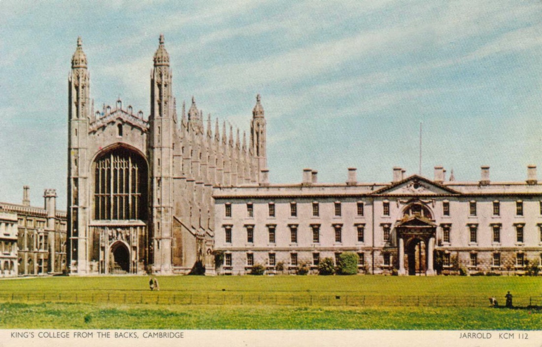
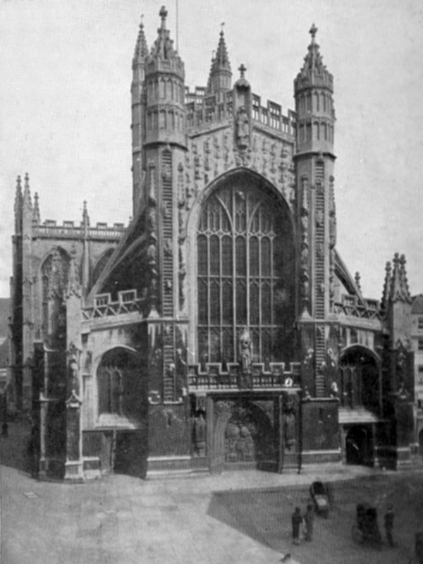
King's was founded in 1441 by Henry VI, soon after he had founded its sister college in Eton.
However, the King's plans for the college were disrupted by the civil war and resultant scarcity of funds, and his eventual deposition.
Little progress was made on the project until, in 1508 Henry VII began to take an interest in the college.
The building of the college's chapel, begun in 1446, was finally finished in 1544 during the reign of Henry VIII.
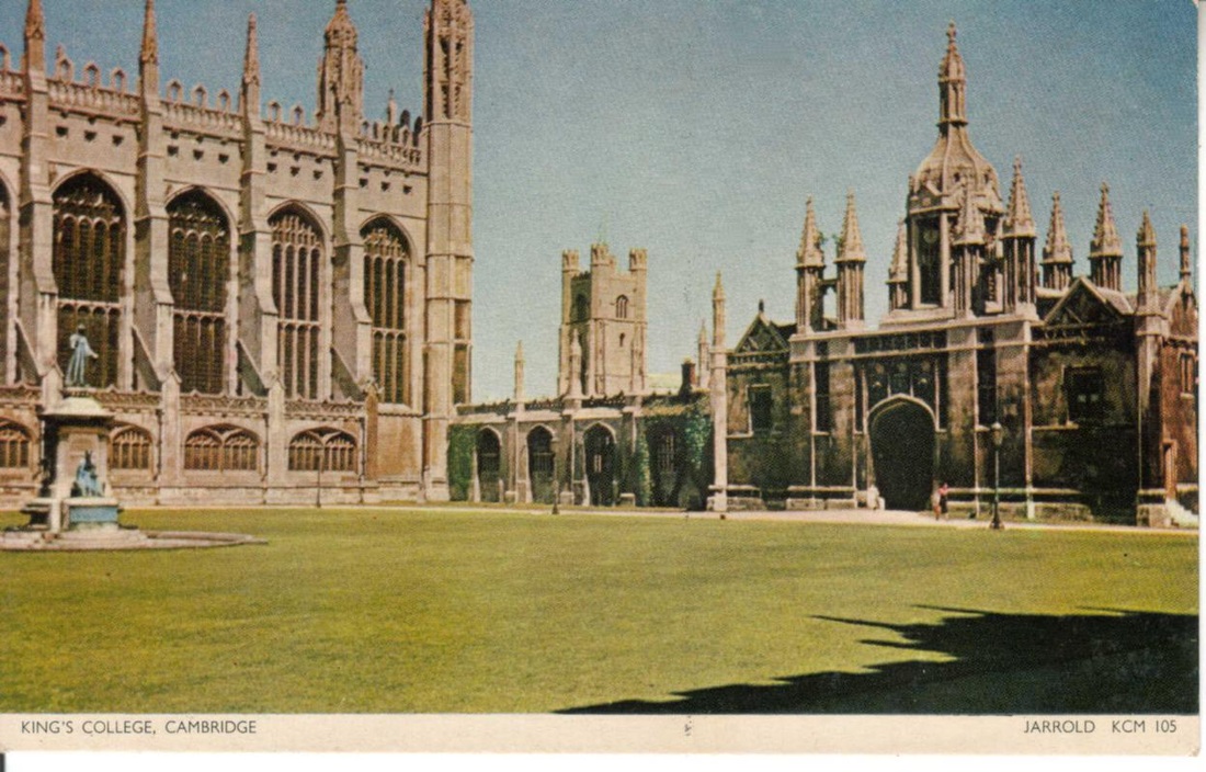
King's chapel is regarded as one of the greatest examples of late Gothic English architecture.
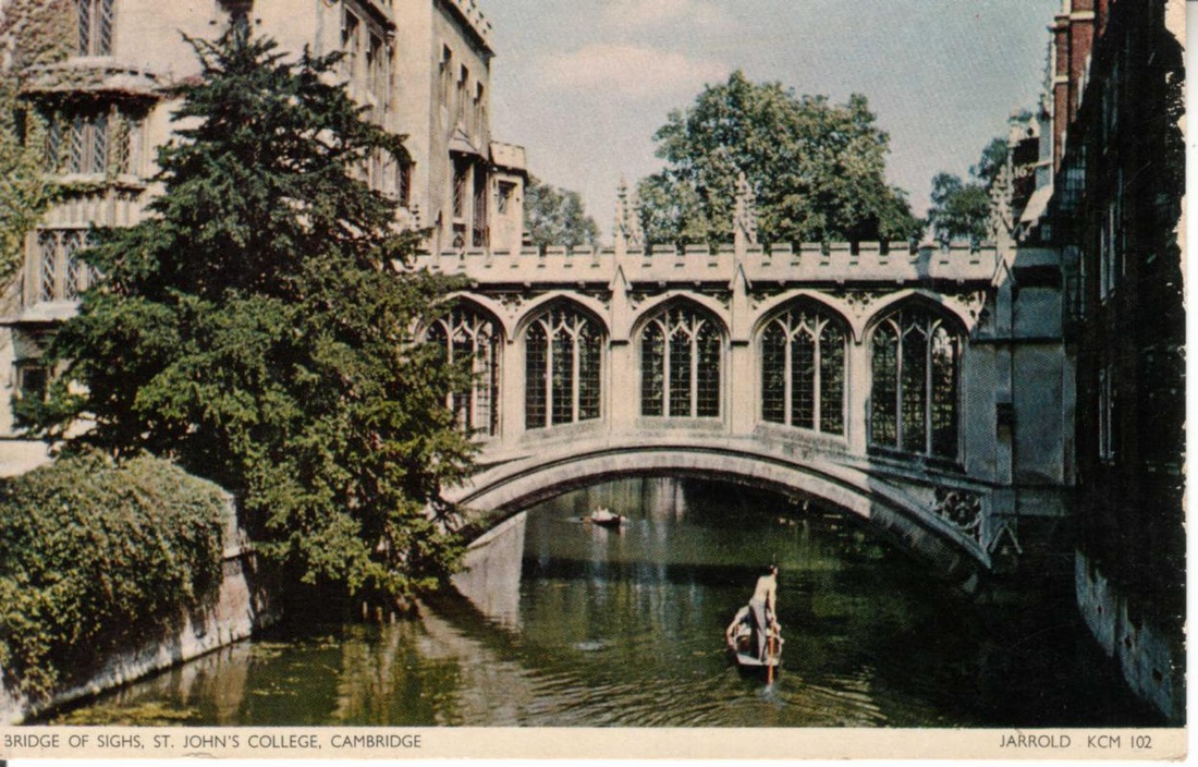
The Bridge of Sighs in Cambridge is a covered bridge belonging to St John's College. It was built in 1831 and crosses the River Cam between two of the college's Courts.
It is named after the Bridge of Sighs in Venice, although they have little architecturally in common beyond the fact that they are both covered.
The bridge is one of Cambridge's main tourist attractions and Queen Victoria is said to have loved it more than any other spot in the city
It is named after the Bridge of Sighs in Venice, although they have little architecturally in common beyond the fact that they are both covered.
The bridge is one of Cambridge's main tourist attractions and Queen Victoria is said to have loved it more than any other spot in the city
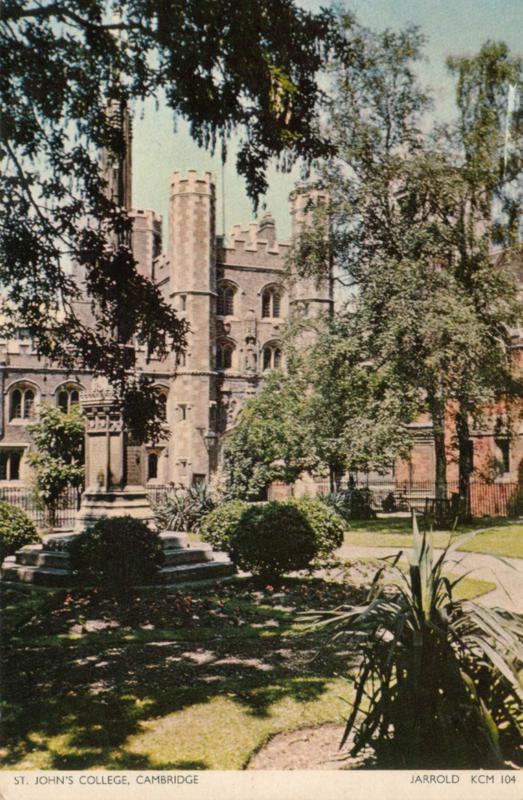
St John’s College was established by Charter dated 9 April 1511.
It was founded on the site of the 13th century Hospital of St John in Cambridge.
Over the course of the following five hundred years, the College expanded westwards towards the River Cam, and now has eleven courts, the most of any Oxford or Cambridge College.
The Great Gate dates from 1516.
It was founded on the site of the 13th century Hospital of St John in Cambridge.
Over the course of the following five hundred years, the College expanded westwards towards the River Cam, and now has eleven courts, the most of any Oxford or Cambridge College.
The Great Gate dates from 1516.
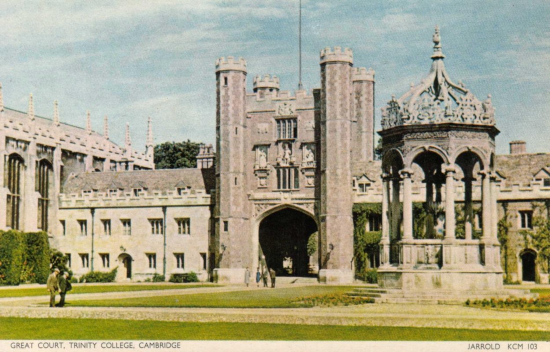
Trinity College was founded by Henry VIII in 1546, from the merger of two existing colleges: Michaelhouse (founded in 1324), and King’s Hall
(established by Edward II in 1317 and refounded by Edward III in 1337).
Most of the Trinity’s major buildings date from the 16th and 17th centuries.
The Great Court was built mainly between 1599 and 1608.
(established by Edward II in 1317 and refounded by Edward III in 1337).
Most of the Trinity’s major buildings date from the 16th and 17th centuries.
The Great Court was built mainly between 1599 and 1608.
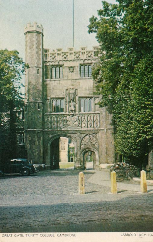
The Great Gate is the main entrance to Trinity College, leading to the Great Court.
A statue of the college founder, Henry VIII, stands in a niche above the doorway..
A statue of the college founder, Henry VIII, stands in a niche above the doorway..
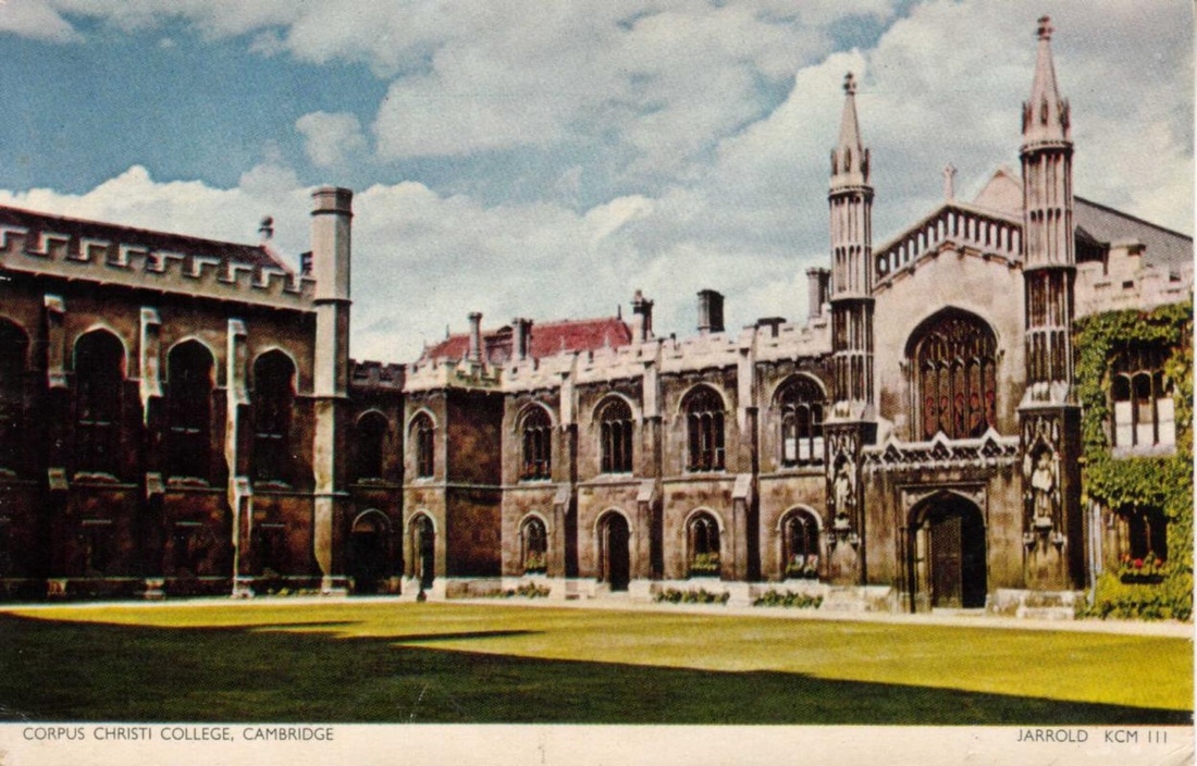
Corpus Christi College is notable as the only college founded by Cambridge townspeople.
It was established in 1352 by the Guilds of Corpus Christi and the Blessed Virgin Mary, making it the sixth-oldest college in Cambridge.
The guild of Corpus Christi was founded in Cambridge in 1349 in response to the Black Death. Its members determined to found a new college in the University of Cambridge, the sixth in the University's history.
Later the same year the new guild merged with an older guild, the Guild of the Blessed Virgin Mary, which had also been decimated by the Plague.
The united guilds acquired land in the centre of Cambridge and their patron, the Duke of Lancaster, applied to King Edward III for a licence to found a new college.
This was granted in 1352..
Construction began immediately of a single modest court near the parish church and it was in use by 1356 .
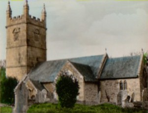
Kenn & Kennford, Devon
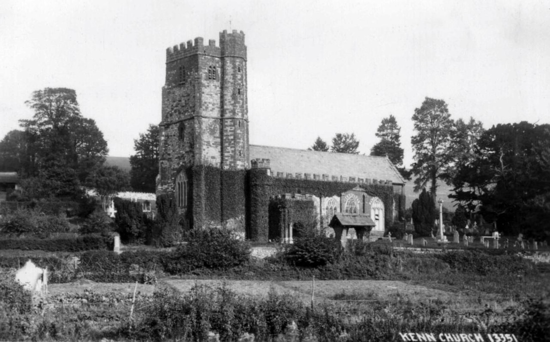
St. Andrew’s Church Kenn, Devon, England, showing lychgate and graveyard.
The bell tower has stood for more than 700 years, and Parish Registers from the church date back to 1538. The church consists of nave, aisles, and chancel, with embattled tower; and it contains a fine carved screen and an ancient font.
The bell tower has stood for more than 700 years, and Parish Registers from the church date back to 1538. The church consists of nave, aisles, and chancel, with embattled tower; and it contains a fine carved screen and an ancient font.
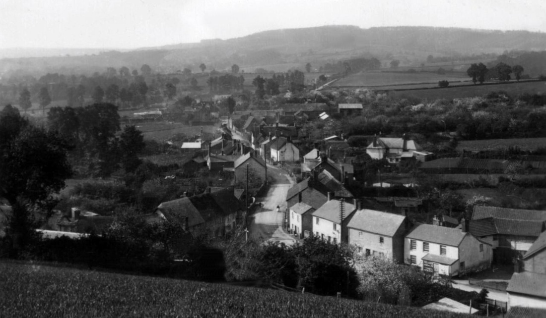
The hamlet of Kennford ,Devon ,as seen in a postcard purchased in 1952.
A school was built at Kennford in 1849 by the local squire J.H. Ley for the the Church of England. The Ley family lived in the area from the early 1700s to the 1950s. The school is still operating.
A school was built at Kennford in 1849 by the local squire J.H. Ley for the the Church of England. The Ley family lived in the area from the early 1700s to the 1950s. The school is still operating.
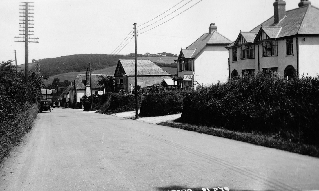
Main road through Kennford in 1952.
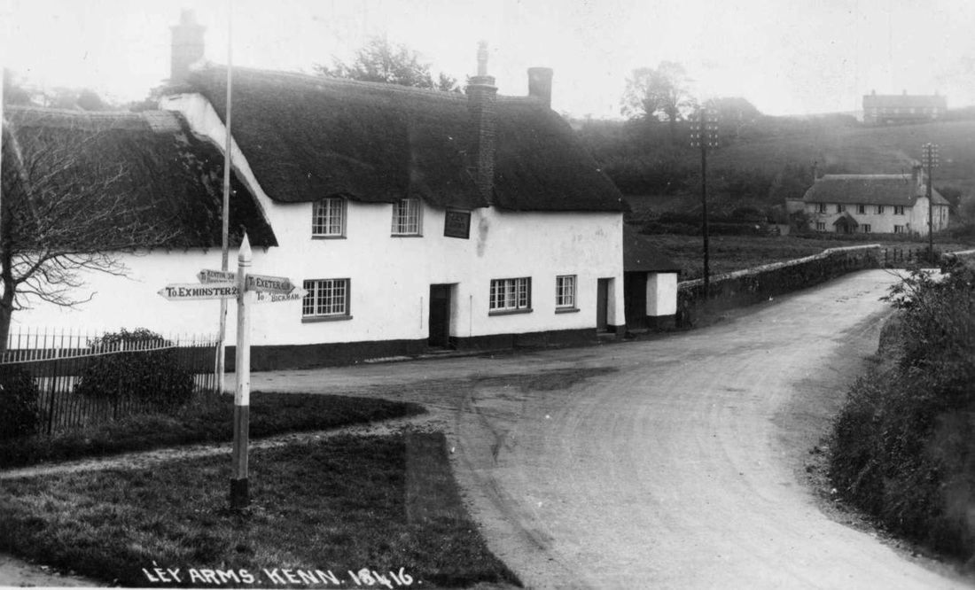
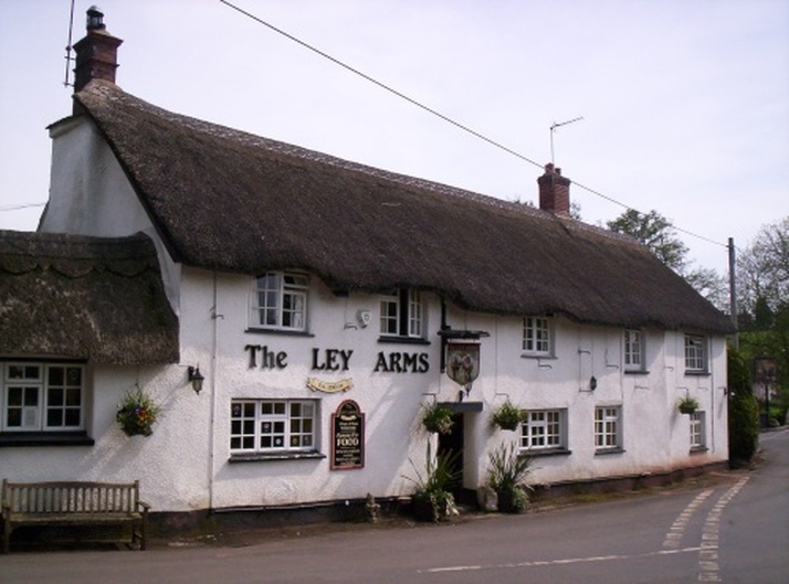
The Ley Arms as seen in 1952.
The old pub in the village of Kenn, Devon, dates from the 1600s.
Originally, it was a two-room building with a passage between, and both rooms had fireplaces.
The building is of whitewashed rendered cob and stone rubble, with a thatched roof, gabled at the ends.
A fire in the 1980s resulted in an extensive remodelling and extension of the building at both ends.
The present-day pub is shown below.
Picture by Brian Detweiler © Pictures of England.com
"http://www.picturesofengland.com/picture/1061202.js?L"
"http://www.picturesofengland.com/picture/1061202.js?L"
Totnes, Devon
Totnes has a long recorded history, dating back to AD 907 when its first castle was built.
It was already an important market town by the 12th century.
Indications of its former wealth and importance are given by the number of merchants' houses built in the 16th and 17th centuries.
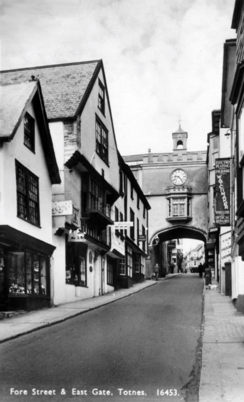
The Eastgate dates from Elizabethan times and is a prominent feature of the town. The original gate, shown in this postcard, had to be rebuilt after it was destroyed by fire in 1990.
It was already an important market town by the 12th century.
Indications of its former wealth and importance are given by the number of merchants' houses built in the 16th and 17th centuries.
The Eastgate dates from Elizabethan times and is a prominent feature of the town. The original gate, shown in this postcard, had to be rebuilt after it was destroyed by fire in 1990.
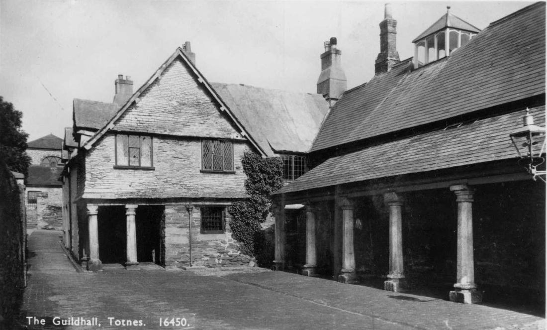
The Guildhall at Totnes is a Tudor-period (16th century ) building which has served as a guildhall, magistrate's court, and prison.
In 1206, Totnes was granted a charter by King John, thereby becoming a free town, and able to make its own laws.
The town’s merchants also gained permission to establish a guild. Their original guildhall was located in the High Street.
In 1553, King Edward VI granted Totnes a charter allowing a former Benedictine priory building that had been founded in 1088 to be used as a Guildhall and school.
The Guildhall was previously used as the monks' refectory.
In 1624, the Guildhall was converted to be a magistrate's court.
Soldiers were billeted here during the English Civil War, and in the Council Chamber there are large oak tables used for discussions in 1646 by Oliver Cromwell and his parliamentary commander-in- chief.
Until 1887, it was also used as the town gaol with the addition of prison cells. It remained a magistrate's court until 1974.
The building is currently (2012) used by Totnes Town Council for meetings and other ceremonial events.
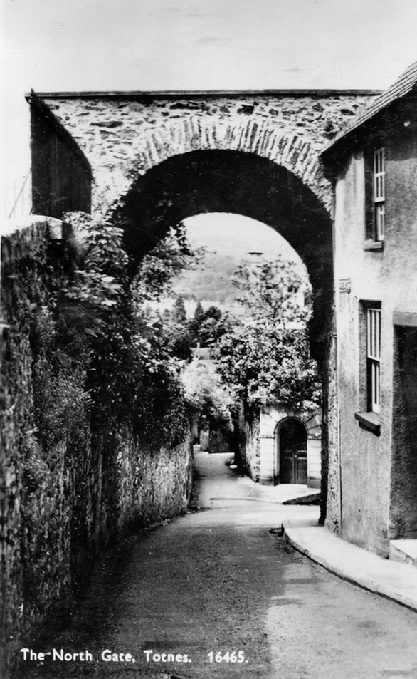
There are only fragments remaining of the walls which once surrounded the town of Totnes.
North Gate is one of those.
North Gate is one of those.
Plymouth, Devon
An Elizabethan House, in New Street, Plymouth, Devon, England.
A relic of the time of Sir Francis Drake,it has a display of furniture and artifacts from that period. It is open to the public.
The house dates from the late 1500s.
A relic of the time of Sir Francis Drake,it has a display of furniture and artifacts from that period. It is open to the public.
The house dates from the late 1500s.
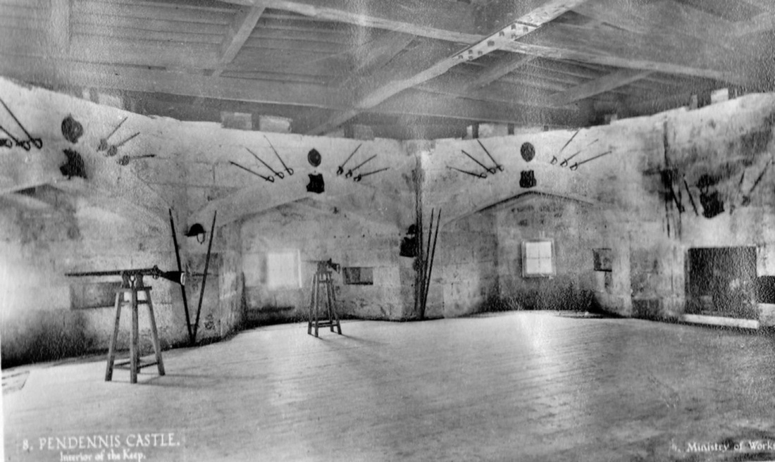
Pendennis Castle, Cornwall
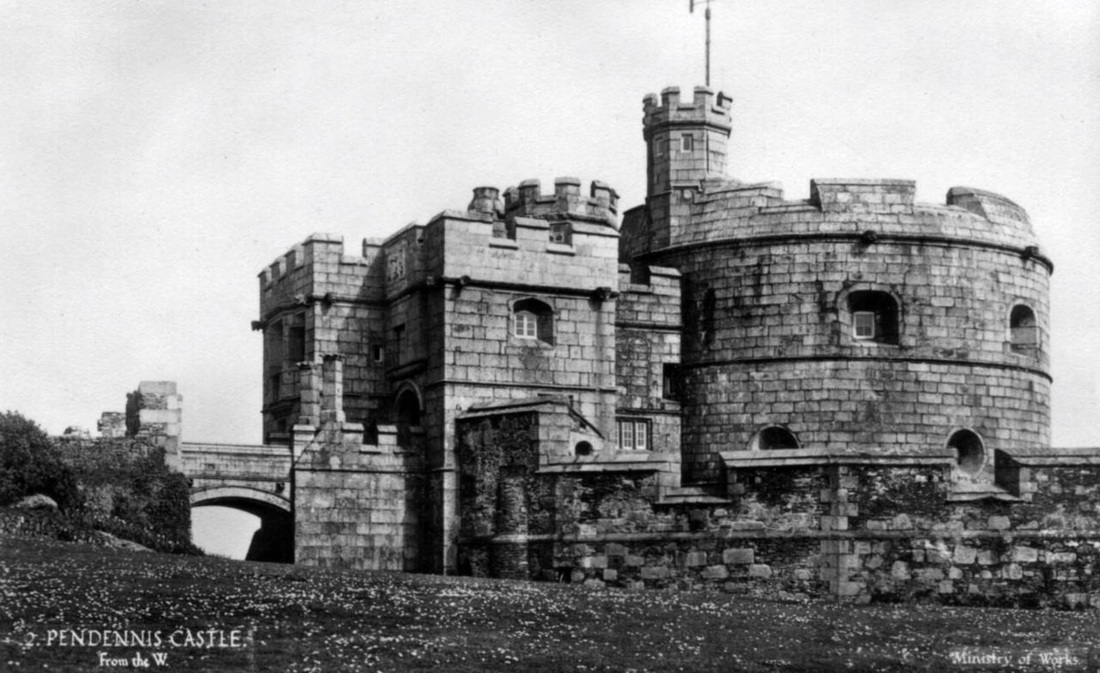
Above and below : Views of Pendennis Castle, Cornwall.
Below shows th interior of the castle Keep.
Pendennis Castle, near Falmouth, was built for King Henry VIII in 1539.
Its duty was to guard the entrance to the River Fal on its west bank, near Falmouth.
A similar castle,St Mawes Castle, was built on the river's east bank.
They were built to defend Carrick Roads , a large body of water near Falmouth , from threats of attack by France and Spain.
The pope at the time had asked both countries to invade England to restore the Catholic religion which King Henry had set aside.
The two castles near Falmouth, were part of a series of fortifications built along England's south-west coast to counter any attack.
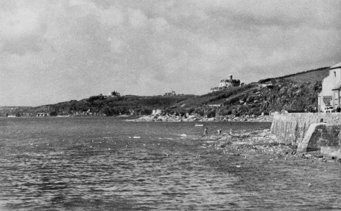
There was only one building in the area which is now Falmouth until the middle of the 1500s.
However, when King Henry VIII had Pendennis Castle built there at this time, the owners of the house, the Killigrew family began to develop the town.
Preparing for a possible attack by France and Spain, Henry also had St Mawes Castle built on the opposite side of the River Fal. A few hundred homes were added to Falmouth after King Charles II granted its Charter in 1661.
Castle on left is St Mawes, with Pendennis Castle on right.
Dover Castle, Kent
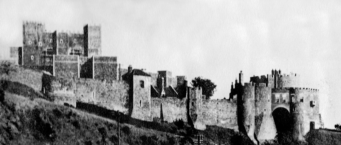
Described as the "Key to England" due to its defensive significance throughout English history, Dover Castle is a medieval castle in the coastal town of the same name.
It's the largest castle in England.
Founded in the 12th century, the castle began to take its present recognisable shape during the reign of Henry II from1154 to 1189.
By the Tudor age, castle defences were being superseded by gunpowder.
But defensive improvements were made at Dover by Henry VIII, who personally visited the castle.
Massive rebuilding took place at the end of the 18th century during the Napoleonic Wars. As Dover became a garrison town during this time, there was a need for barracks and storerooms for the extra troops and their equipment.The solution was the creation of a complex of barracks tunnels about 15 metres below the cliff top, and the first troops were accommodated in 1803.
At the height of the Napoleonic Wars, the tunnels housed more than 2,000 men. ..
The tunnels were abandoned for more than a century after 1826.
The outbreak of the Second World War in 1939 saw the tunnels converted first into an air-raid shelter and then later into a military command centre and underground hospital.
Later, during the Cold War, the tunnels were readied for use as a nuclear shelter.
The almost five kilometres (three miles) of tunnels go deep into the chalky cliffs below Dover Castle.
Goodrich Castle, Hereford-shire
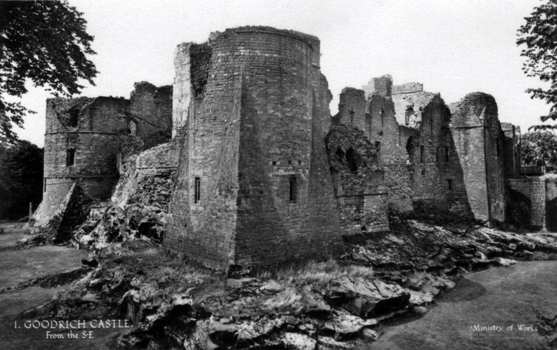
Goodrich Castle Hereford-shire,England.
The castle appears to have been in existence by 1101, when it was known as Godric’s Castle, named probably after Godric of Mappestone, a local Anglo-Saxon thane and landowner mentioned in the Domesday Book of 1086.
Victorian historians, however, believed the castle to date back further to the pre-Norman conquest days of King Canute, and the site may have been among a small number of Saxon fortifications along the Welsh border.
Goodrich Castle was initially an earth and wooden fortification.
In the middle of the 12th century the original castle was replaced with a stonekeep, and was then expanded significantly during the late 13th century.
During the English Civil War, Goodrich was held successively by both sides. Royalists eventually surrendered in 1646 under threats of undermining and a deadly Parliamentarian mortar. The famous 'Roaring Meg', the only surviving Civil War mortar, ruined the castle in 1646.
Stirling Castle, Scotland
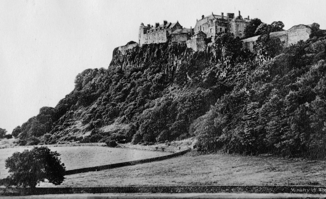
Stirling Castle,at Stirling,Scotland.
Located on the top of Castle Hill , it is surrounded on three sides by steep cliffs giving it a strong defensive position.
It was an important military feature of Scotland for hundreds of years.
Most of the main buildings date from the 1400s and 1500s
A few structures built in the 1300s also remain, while the outer defences which face the town of Stirling date from the early 1700s.
Several Scottish Kings and Queens have been crowned at Stirling, including Mary, Queen of Scots, in 1543.
Kenilworth Castle, Warwickshire
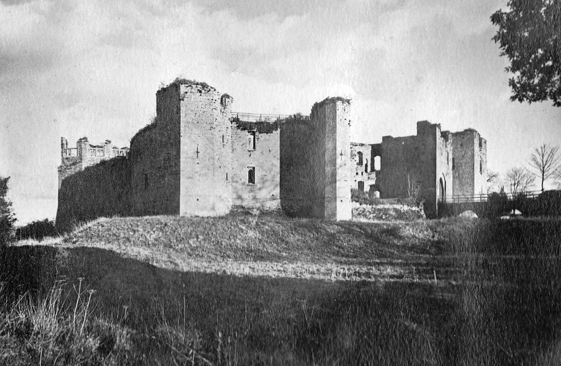
The castle was constructed ,using local new red sandstone, from Norman through to Tudor times .
Founded in the 1120s around a powerful Norman great tower, the castle was greatly enlarged by King John at the beginning of the1200s.
Local streams were dammed at that time to create huge water defences. These and a strengthening of fortifications enabled Kenilworth Castle to withstand a six-month siege during the War of The Roses in 1266. This is believed to have been the longest siege in English history.
Kenilworth's usefulness ended when it was partly destroyed by Parliamentary forces in 1649 during the English Civil War..
Braemar Castle, Scotland
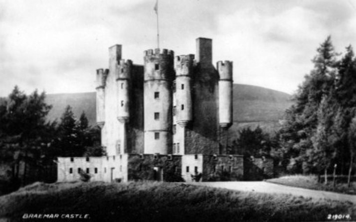
Braemar Castle is situated near the village of Braemar in Aberdeenshire, Scotland.
The present Braemar Castle was constructed in 1628 by John Erskine, 18th Earl of Mar. It was attacked and burned in 1689 by Jacobite supporters to prevent it from falling into the hands of Government forces.
In 1715 the castle was forfeited to the Crown following the Earl's leadership of the failed rebellion.
The castle and lands were purchased by John Farquharson, 9th Laird of Invercauld ,but the building was left in ruins until 1748 when it was leased to the government at a fee of £14 per year.
Rebuilding started , and it was an important garrison for Government troops until 1831.
The castle is now under the.possession of the chief of Clan Farquharson and is leased to a local charitable foundation. It is open to the public.
Braemar Castle is reputed to have at least four ghosts in residence.
Caernarfon Castle, Wales
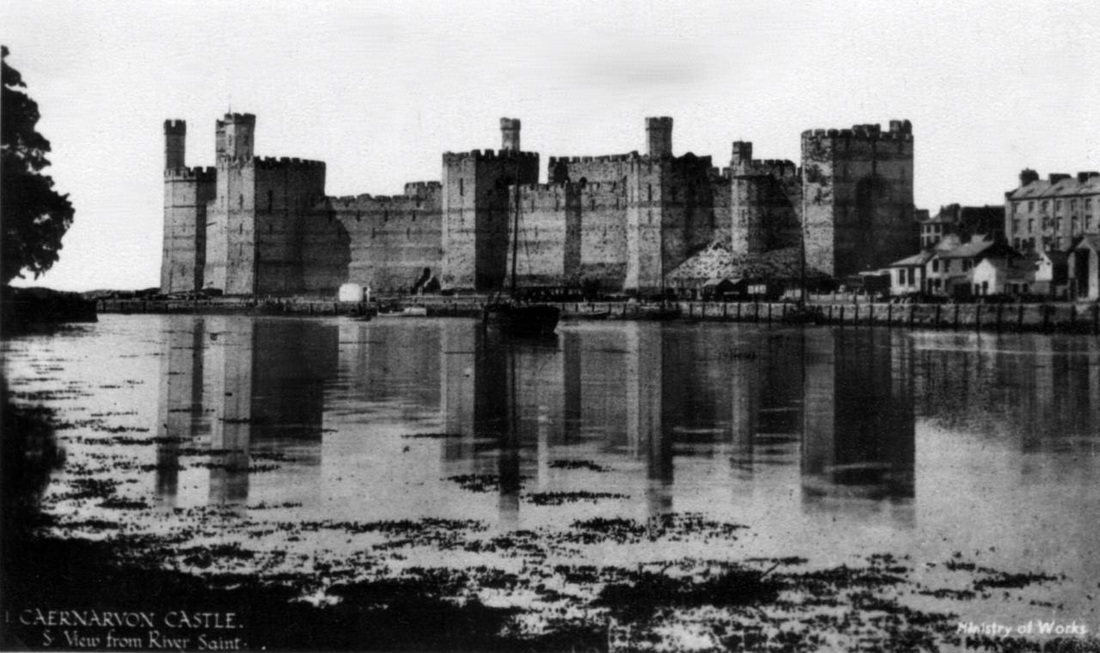
The first fortifications at Caernarfon in north-west Wales were built by the Romans. The present Castle dates from medieval times.
There was a motte-and-bailey castle in the town of Caernarfon from the late 11th century until 1283 when King Edward I of England began replacing it with the current stone structure.
While the castle was under construction, town walls were also built around Caernarfon.
The town and castle were sacked in 1294 during a rebellion against the English.
But Caernarfon was recaptured from the rebels the following year.
Caernarfon Castle was allowed to fall into a state of disrepair as tensions diminished between the Welsh and English ,following Tudors gaining the English throne in 1485.
State funds began to be used on repairs in the 19th century, and the castle and town walls are now a World Heritage Site.
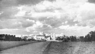
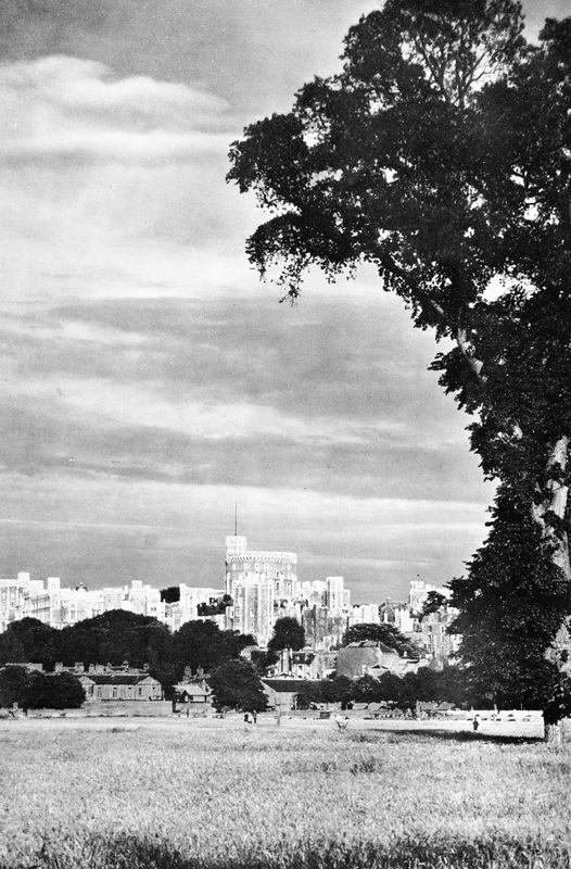
Windsor Castle, England.
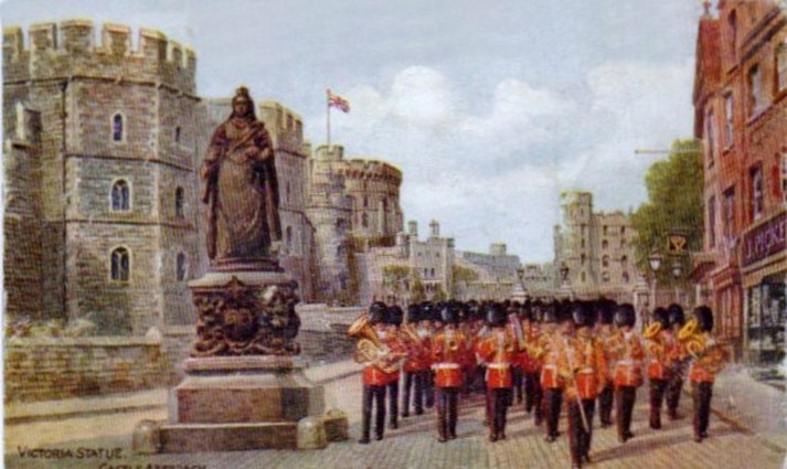
Guards parade past the Queen Victoria Statue on the approach to Windor Castle.
Windsor Castle
The views below are from a souvenire booklet purchased at Windsor Castle on 30 June 1952
The views below are from a souvenire booklet purchased at Windsor Castle on 30 June 1952
|
|
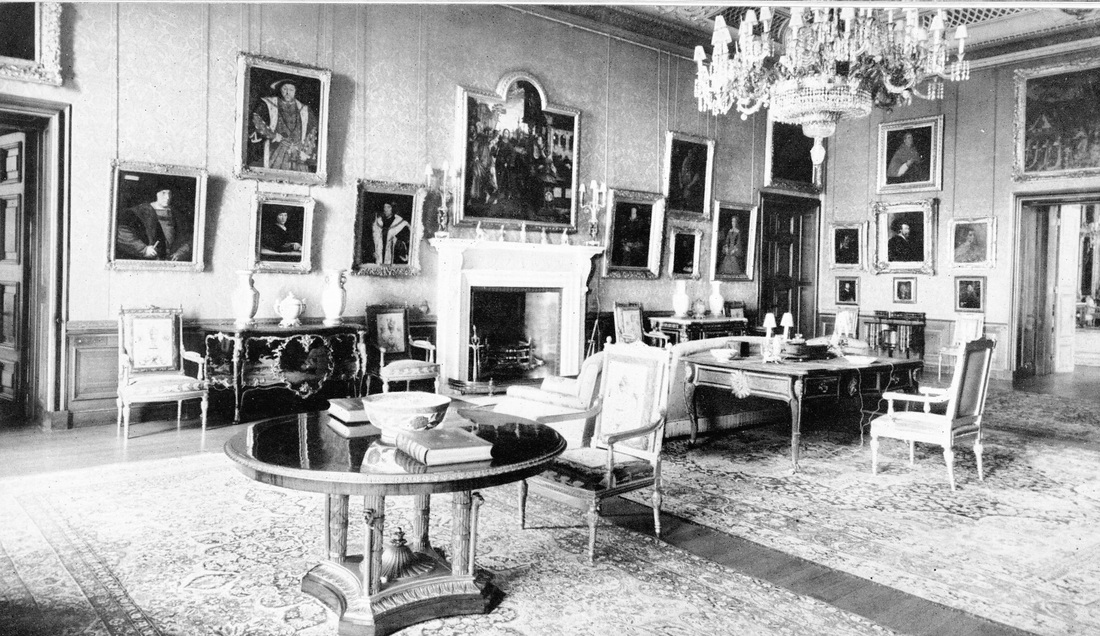
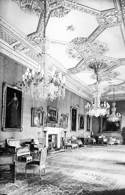
(L)From The Long Walk
(R)The Van Dyck Room
(R)The Van Dyck Room
|
|
(L)From The North West
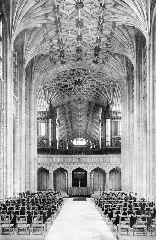
(R)The Nave, St George's Chapel
(R)The Nave, St George's Chapel
|
|
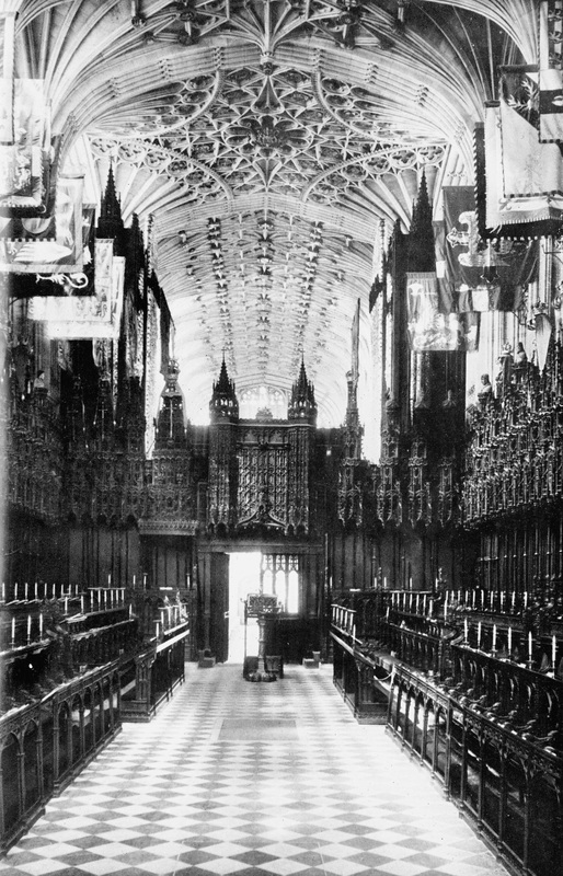
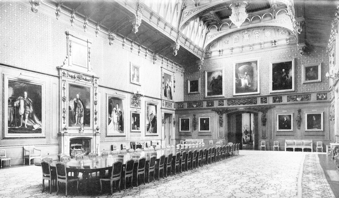
(L)The Choir, St George's Chapel
(R)The Picture Gallery
(R)The Picture Gallery
|
|
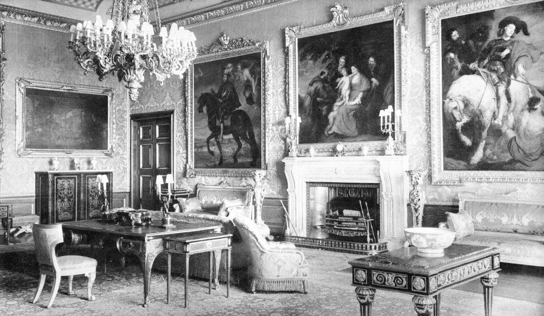
(L)The Rubens Room
(R)The Waterloo Chamber
(R)The Waterloo Chamber
Buckfast Abbey , Devon.
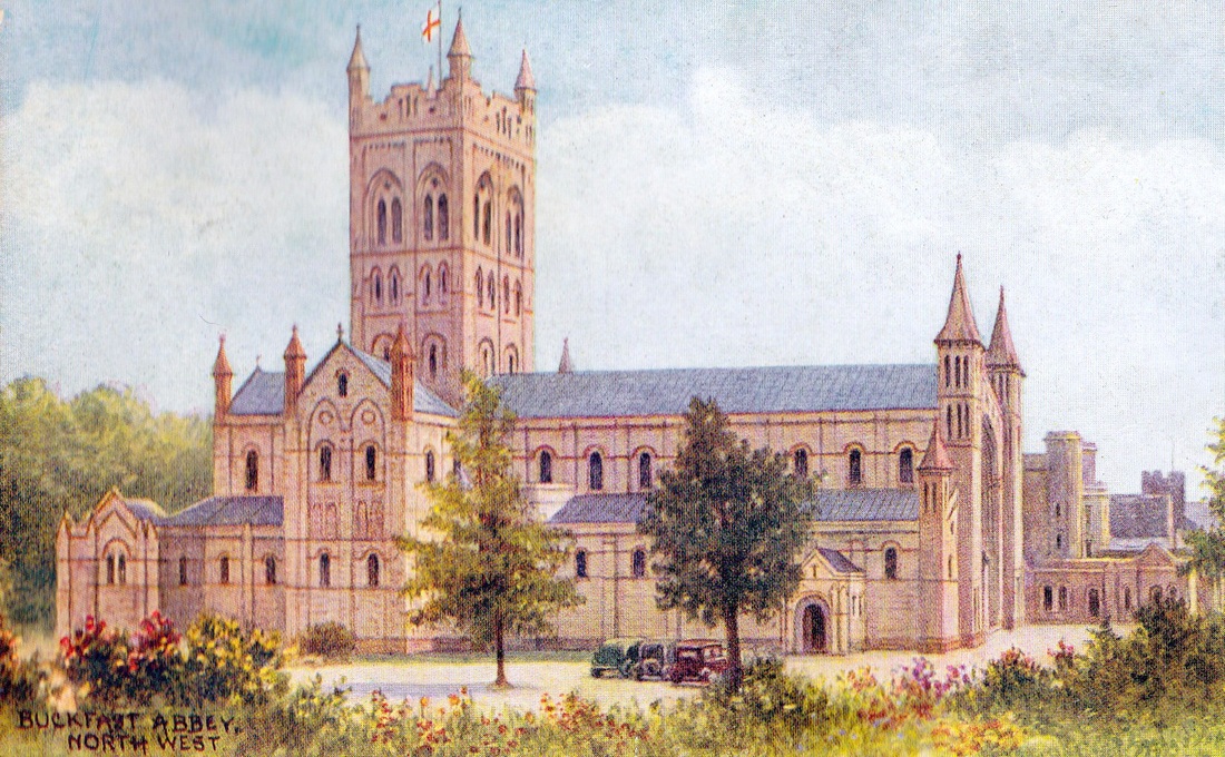
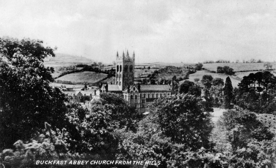
The abbey was founded in the reign of King Cnut in 1018.
It became a Cistercian abbey in 1147 and was rebuilt in stone.
In medieval times, the abbey became rich through fishing and trading in sheep wool.
The Black Death plague killed two abbots and many monks and by 1377 there were only fourteen monks left at Buckfast.
On 25 February 1539, a representative of King Kenry VIII arrived and declared the abbey to be dissolved on the king's orders.
The monks were forced to leave and the buildings were looted and destroyed.
The abbey then stood in ruins for over two hundred years.
Monks began living at Buckfast Abbey again in 1882, and today it is a Benedictine Monastery.
Anne Hathaway's Cottage, Warwickshire
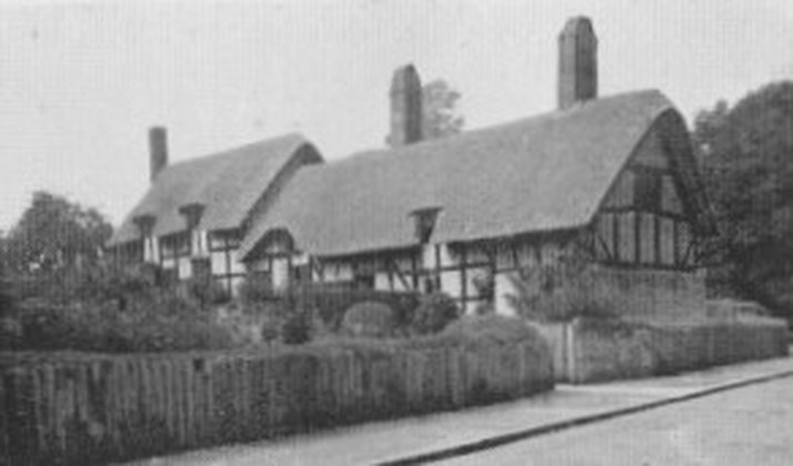
Anne Hathaway's Cottage is a twelve-roomed farmhouse where the wife of William Shakespeare lived as a child in the village of Shottery, Warwickshire, England, about 1.6 km (1 mile) west of Stratford-upon-Avon.
The earliest part of the house was built before the 1400s.
The cottage was passed down the Hathaway family, and although they sold it to the Shakespeare Birthplace Trust in 1846, Hathaway descendants lived in it until 1892.
In 1969 the cottage was badly damaged in a fire, but was restored by the Trust.
It is now open to public visitors as a museum.
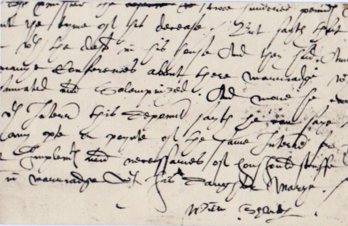
A postcard showing William Shakespear's handwriting and his signature.
Domesday Book
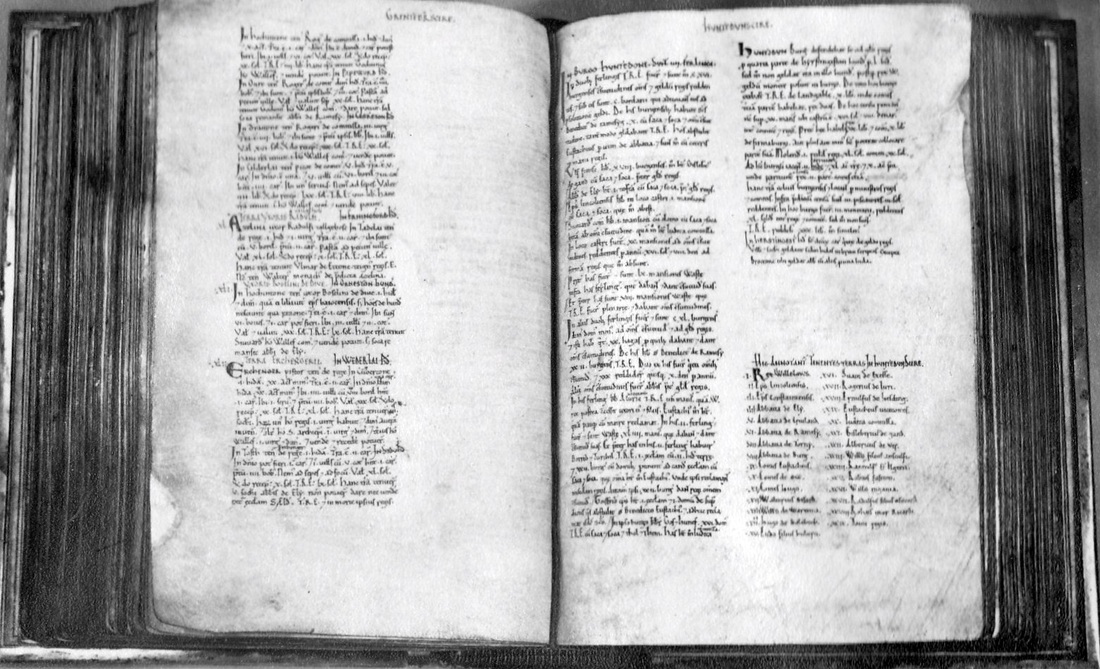
The original hand-written book is now held at The National Archives, Kew, in South West London.
It is the record of the great survey of much of England and parts of Wales completed in 1086, on the orders of William I of England (William the Conqueror).
The judgment of the Domesday Book assessors was final. Whatever the book said about who held the material wealth or what it was worth, was the law, and there was no appeal.
Printed copies have been made over the centuries, and the document can now be viewed on-line.
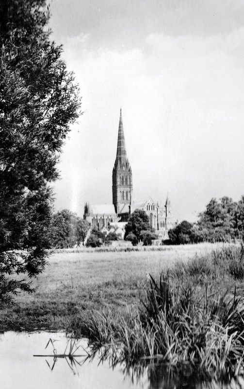
Salisbury Cathedral, Wiltshire
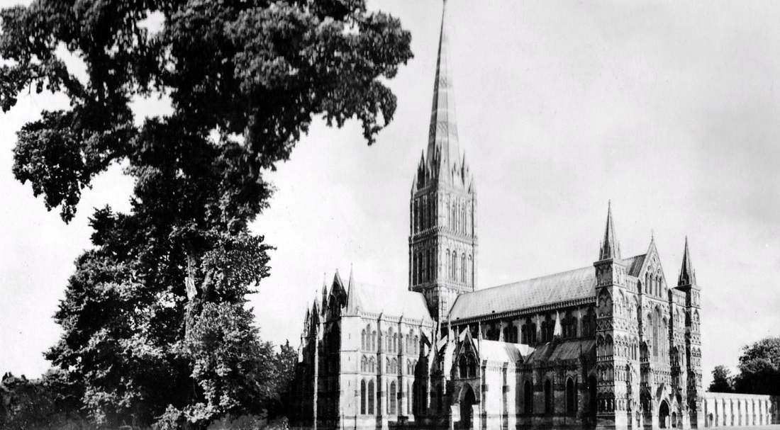
Above and Below: Photos of Salisbury Cathedral, Wiltshire.
Although commonly known as Salisbury Cathedral, the official name is the Cathedral of Saint Mary.
An Anglican cathedral , Salisbury is considered one of the leading examples of Early English architecture.
The main body of the church was completed in 38 years, between 1220 and 1258.
Among its treasures are the best surviving of the four original copies of Magna Carta, and what's claimed as the oldest working modern clock in the world.
The clock has no face or hands because all clocks at the time it was made, in 1386, rang out the hours on a bell.
It was originally housed in a bell tower that was demolished in 1792. The clock was then moved to the Cathedral Tower where it operated until 1884.
After being placed in storage that year, it was forgotten about until it was discovered in 1929, in a cathedral attic.
The clock was repaired and restored to working order in 1956. Further repairs were carried out in 2007.
York, Yorkshire
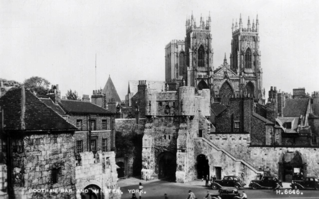
Bootham Bar and York Minster.
The walls around the city are punctuated by four main gatehouses, or 'bars', (Bootham Bar, Monk Bar, Walmgate Bar and Micklegate Bar) These restricted traffic in medieval times, and were used to extract tolls, as well as being defensive positions in times of war.
Much of Bootham Bar was built in the 14th century. But it has some of the oldest surviving stonework, dating to the 11th century. It also stands almost on the site the north western gate of the walled Roman fort town Eboracum, later to become York.
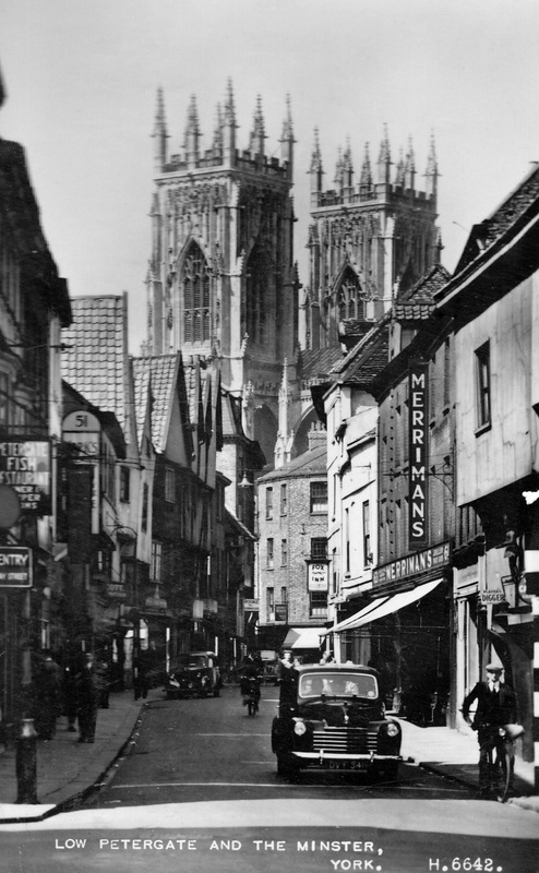
Low Petergate and York Minster.
Low Petergate is one of York's main business and shopping areas.
York Minster is the seat of the Archbishop of York, the second-highest office of the Church of England.
The title "minster" is attributed to churches established in the Anglo-Saxon period as missionary teaching churches, and serves now as an honorific title.
The first recorded church on the site was a wooden structure built in 627. The present building was begun in about 1230 and completed in 1472.
London
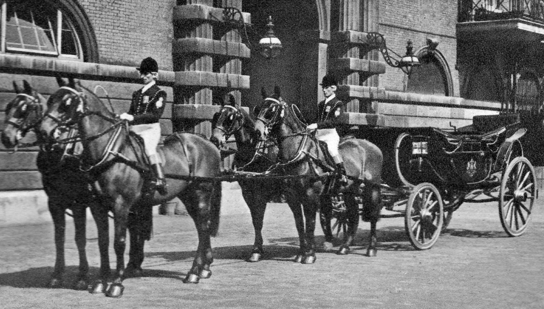
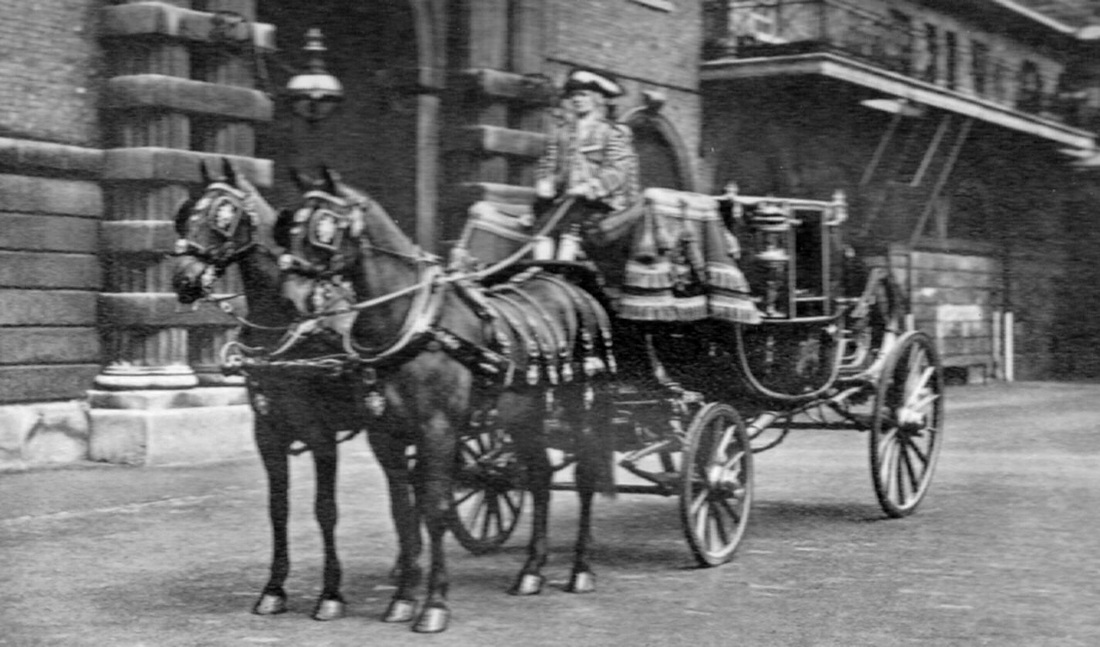
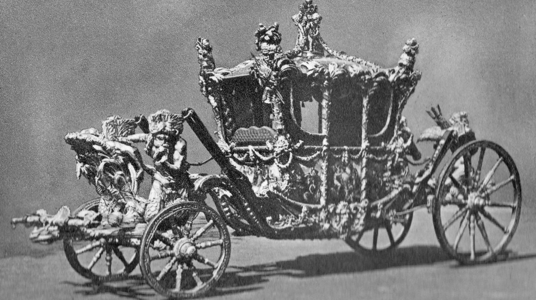
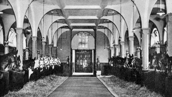
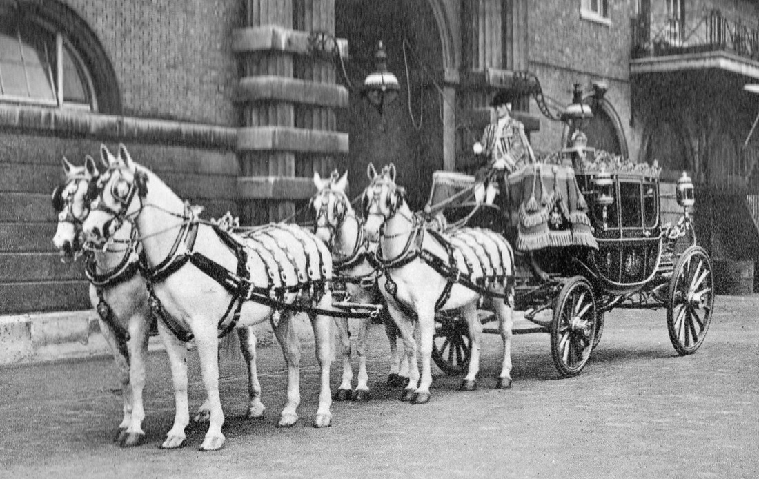
Royal Mews, Buckingham Palace.
The postcards below were purchased at the Royal Mews in 1952.
The Royal Mews is in the grounds of Buckingham Palace, to the south of Buckingham Palace Gardens.
It has been there since the 1820s when the old Mews at Charing Cross was demolished and Trafalgar Square was created on the site.
The Charing Cross site was the place where the royal hawks were kept from 1377.
The name Mews derives from the fact that the birds were confined there at “mew” (moulting) time.
The building was destroyed by fire in 1534 and rebuilt as a stables, but kept its former name.
The state coaches and other carriages are kept at the Royal Mews, along with about 30 horses, and their modern counterparts, the state motor cars.
Coachmen, grooms, chauffeurs and other staff are accommodated in flats above the carriage houses and stables.
The Royal Mews is regularly open to the public.
|
|
|
|
Old YMCA Building
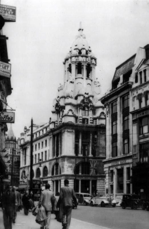
The Old YMCA Building, Tottenham Court Road , London, England.
The building was opened in 1912.
It escaped damage in The Blitz of WW2, while several nearby buildings were destroyed.
The building was opened in 1912.
It escaped damage in The Blitz of WW2, while several nearby buildings were destroyed.
The Monument
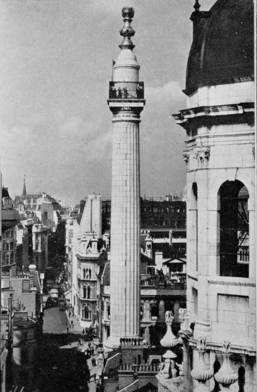
The 62 metre (202 ft) high stone monument commemorates the Great Fire of London which started nearby in 1666. The structure, the tallest isolated stone column in the world, was built between 1671 and 1677. Visitors reach a caged viewing platform near the top of the column by a winding staircase which has 311 steps.
Trafalgar Square
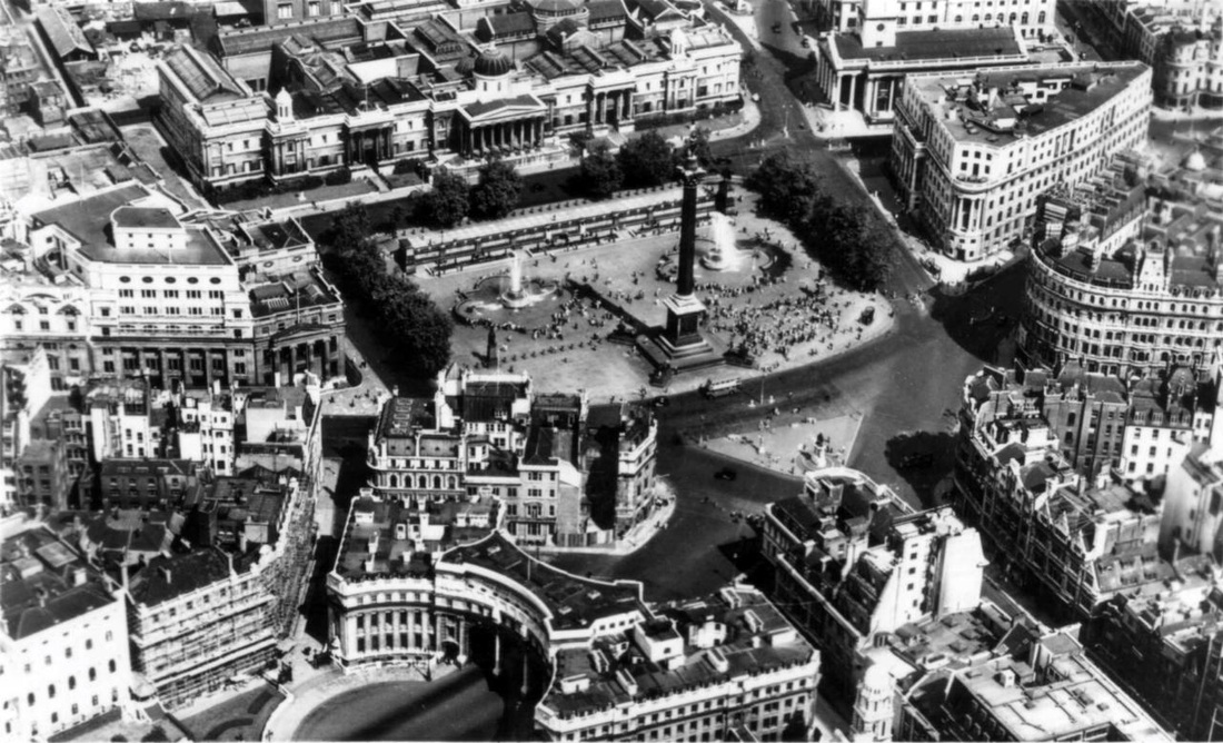
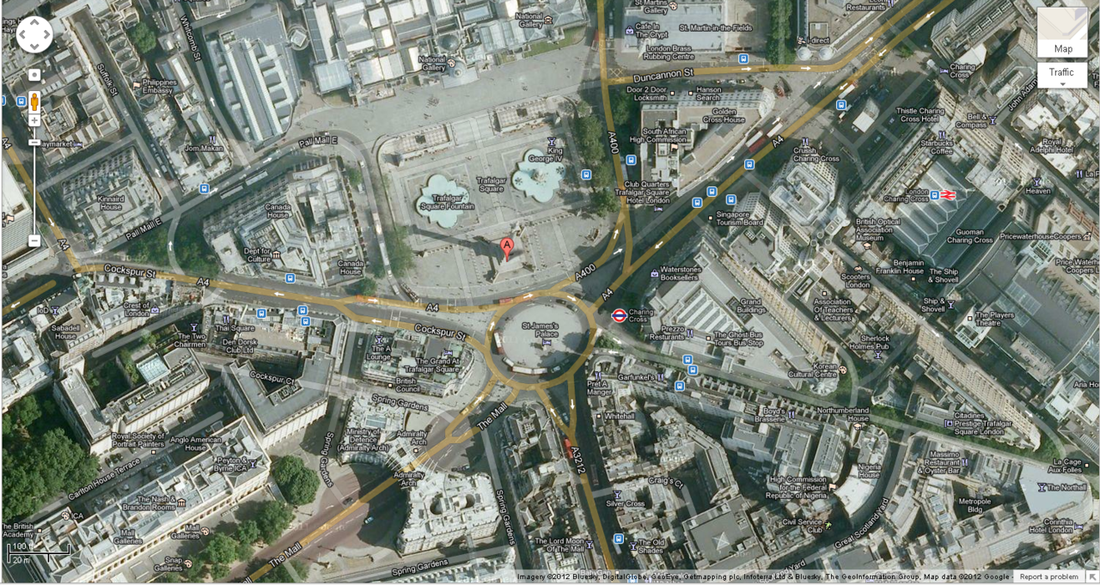
It is interesting to compare these two views of Trafalgar Square taken 60 years apart.
Above is a postcard with a view from the air showing the square as it was in 1952.
Below is a view from Google Maps showing how the square looks now (2012).
Above is a postcard with a view from the air showing the square as it was in 1952.
Below is a view from Google Maps showing how the square looks now (2012).
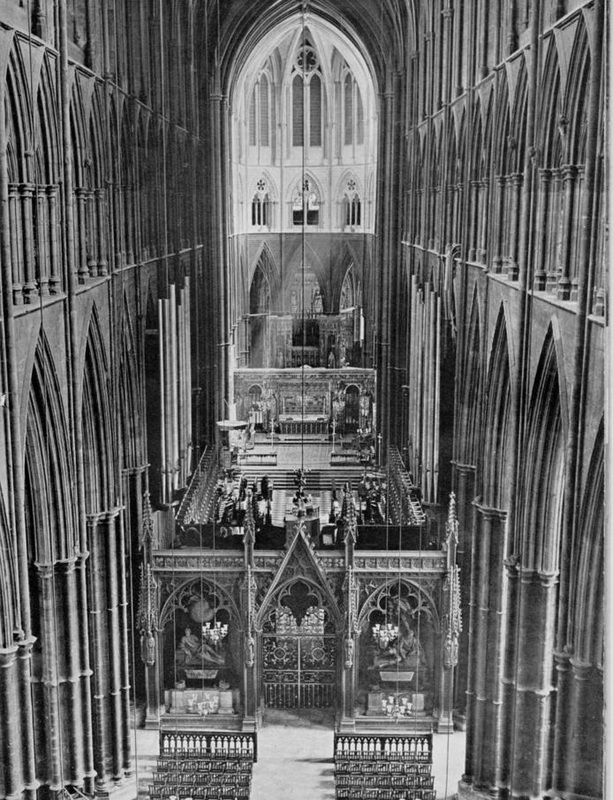
Westminster Abbey
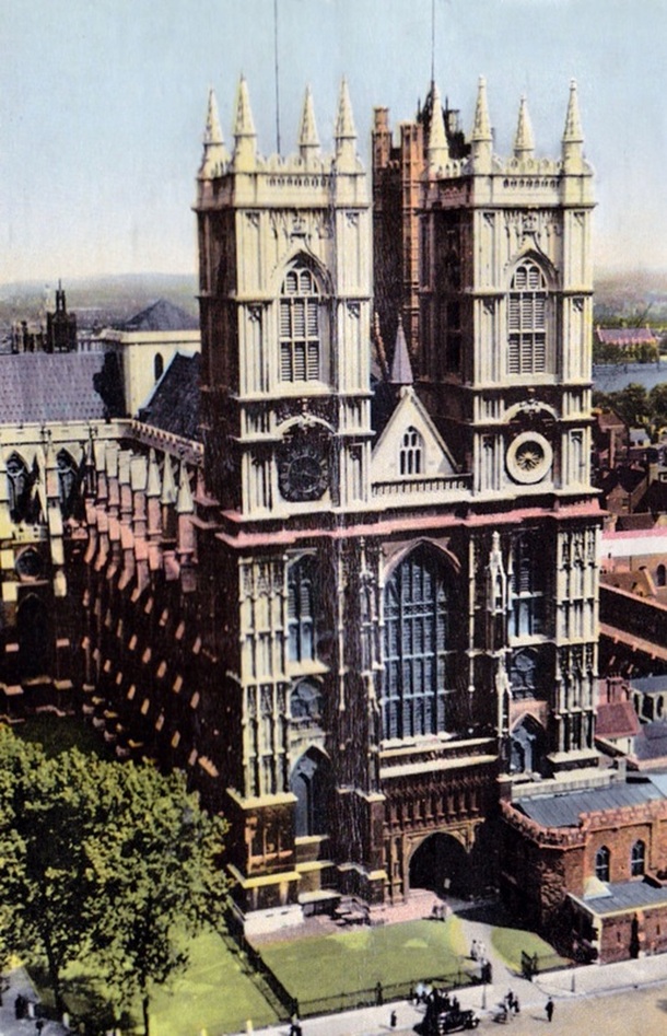
The coronations of English and British monarchs have been held in Westminster Abbey since 1066.
That year there were two kings crowned...King Harold who died later that year in battle against the invading Normans....and the victor of the invasion battle, William the Conqueror.
Westminster Abbey also has a long tradition as a venue for royal weddings
There have been at least 16 of these held at Westminster Abbey since 1100, although there was a 537-year break between 1382 and 1919.
Only two of the Abbey weddings were of the reigning monarch of the time.
Henry I married Matilda of Scotland on 11 November 1100 and Richard II married Anne of Bohemia on 20 January 1382.
The more than 500-year "drought" of royal weddings was broken on 27 February 1919 when HRH Princess Patricia of Connaught, a granddaughter of Queen Victoria, was married to Capt The Hon Alexander Ramsay DSO.
Houses of Parliament
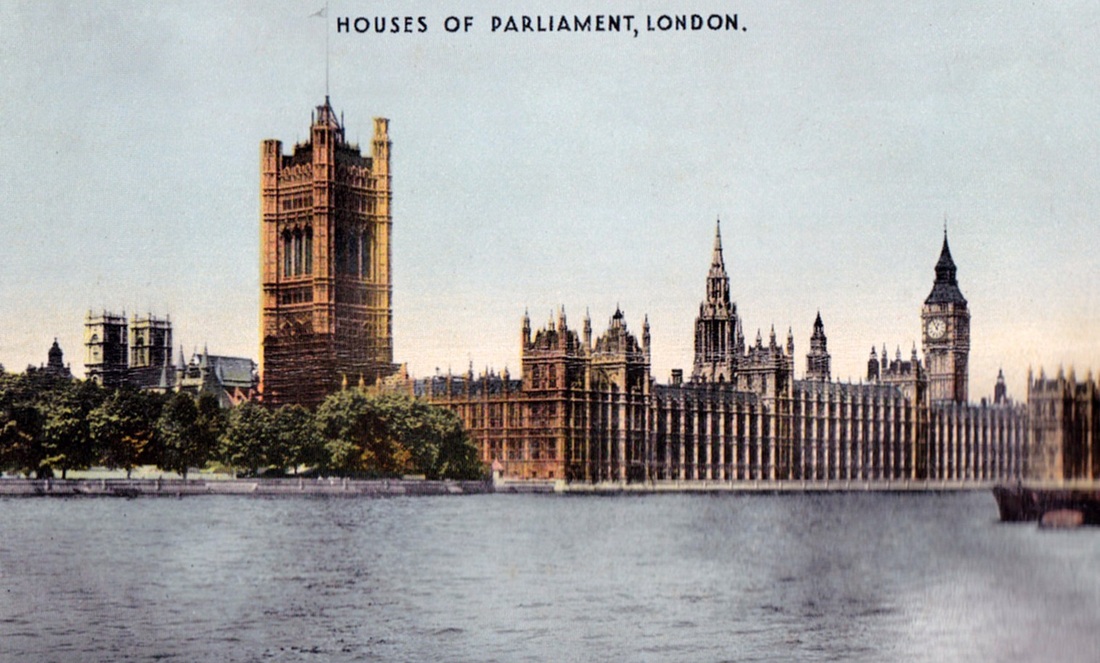
The Palace of Westminster is the meeting place of the House of Commons and the House of Lords, the two houses of the Parliament of the United Kingdom.
Commonly known as the Houses of Parliament , the Palace lies on the bank of the River Thames in the City of Westminster, in central London. Its name derives from nearby Westminster Abbey.
The Old Palace of Westminster was a medieval building complex that was destroyed by fire in 1834.
Its replacement ,New Palace, is the building that stands today. It was built between 1840and 1870.
For ceremonial purposes, the palace has the style and status of a royal residence.
The Elizabeth Tower, which is often referred to by the name of its main clock bell, "Big Ben", is an iconic landmark of London and the United Kingdom in general.
Piccadilly Circus
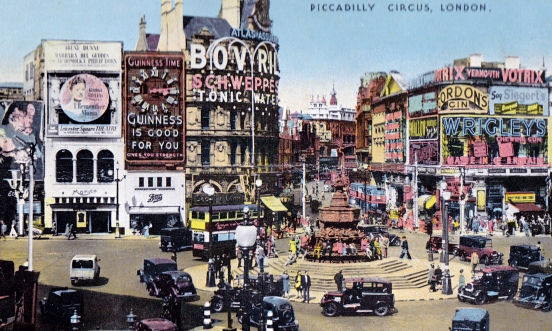
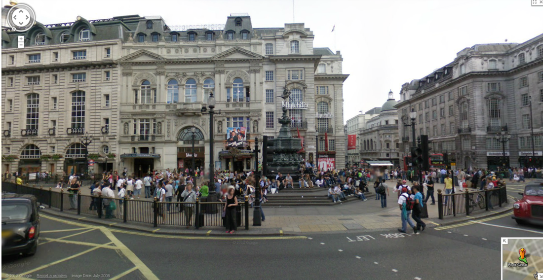
This postcard purchased in 1952 ( top picture) shows Piccadilly Circus as it was then . Below it is a Google Maps view of the Circus as it is today.
The Shaftesbury Monument Memorial Fountain,topped by a winged nude statue of Anteros, the Greek god of requited love, was on a traffic island in the centre of the road junction in London's West End.
The Circus, originally built in 1819, underwent reconstruction work in the late 1980s, and the entire fountain was moved from the centre to its present location at the southwestern corner of the circus.
Circus, in this context, is derived from the Latin word meaning "circle", to describe a round open space at a street junction.
Hampton Court Palace
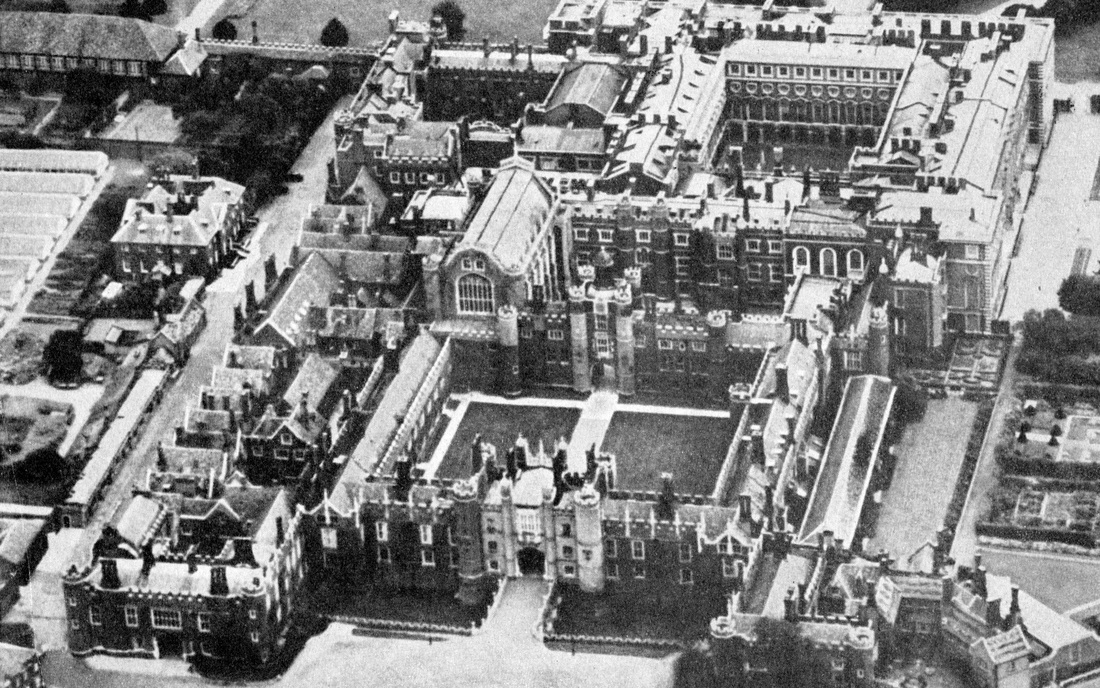
This aerial view shows the size and spread of the palace.
It also shows the different designs of the palace parts. There's the Tudor-era palace developed by Cardinal Wolsey in the early 1500s, and later King Henry VIII, and a baroque palace designed by the famous English architect, Sir Christopher Wren.
Soon after their joint accession to the English throne in 1689 ,King William III and Queen Mary II commissioned Wren to rebuild Hampton Court.
Wren's original plan was to demolish the entire Tudor palace, except for the Great Hall.
Neither the time nor the money was available for such a vast project.
Instead, Wren had to be content with rebuilding the king's and queen's main apartments on the site of old Tudor lodgings.
Both Mary and William died before the completion of the work.
Denham Bridge, Devon
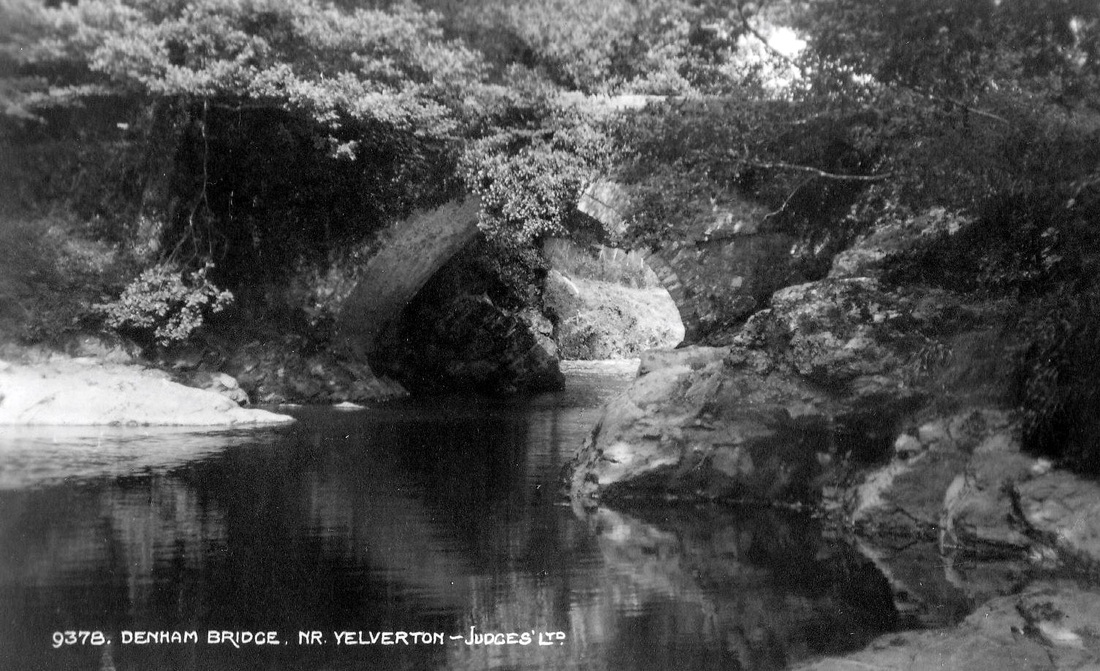
A narrow bridge over the River Tavy, near Yelverton, Devon.
There has been a bridge on this site since at least medieval times.
But, this bridge made with rubble walls probably dates from the 1600s.
Major repairs were carried out in the 1800s.
There has been a bridge on this site since at least medieval times.
But, this bridge made with rubble walls probably dates from the 1600s.
Major repairs were carried out in the 1800s.
Yelverton, Devon
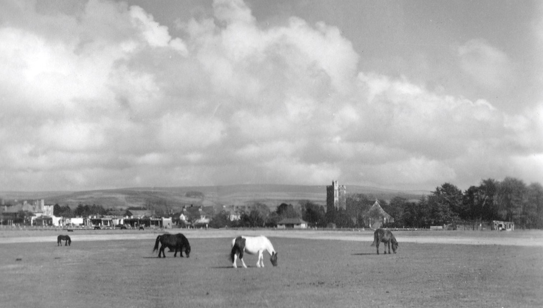
Unlike many villages in Devon, Yelverton , on the edge of Dartmoor, has only a short history. The village owes its existence to the arrival of railway services in 1858. A station was sited near the old Elford Town Farm. Due to the dialect of locals this was transformed into Yelverton
The village became popular with workers who commuted to Plymouth. The passenger railway closed 10 years after this postcard was purchased. However, the Plym Valley Railway group has since reopened a section of it as an historical tourist attraction.
The village became popular with workers who commuted to Plymouth. The passenger railway closed 10 years after this postcard was purchased. However, the Plym Valley Railway group has since reopened a section of it as an historical tourist attraction.
The Major Oak,Sherwood Forest, Nottinghamshire.
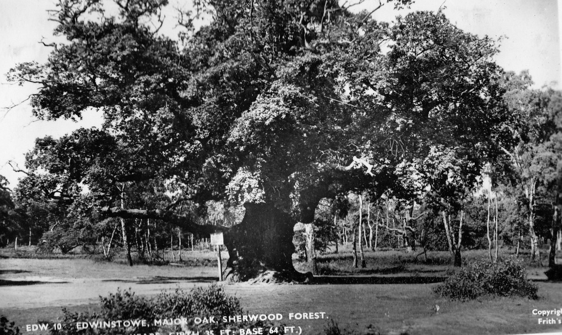
The area has been continuously forested since the end of the Ice Age.
The forest, now just a remnant of a much larger royal hunting forest, has gained fame from medieval times through its association with the legend of the 12th century folk hero Robin Hood.
Hood and his band of “merry men” are known for "robbing from the rich and giving to the poor".
They are said to have lived in Sherwood Forest, and the famous Major Oak is said to have been Hood’s main hideout.
The oak is between 800 and 1000 years old.
Cuttings have been taken with the intention of having clones of the Major Oak planted in cities around the world.
Redruth, Cornwall
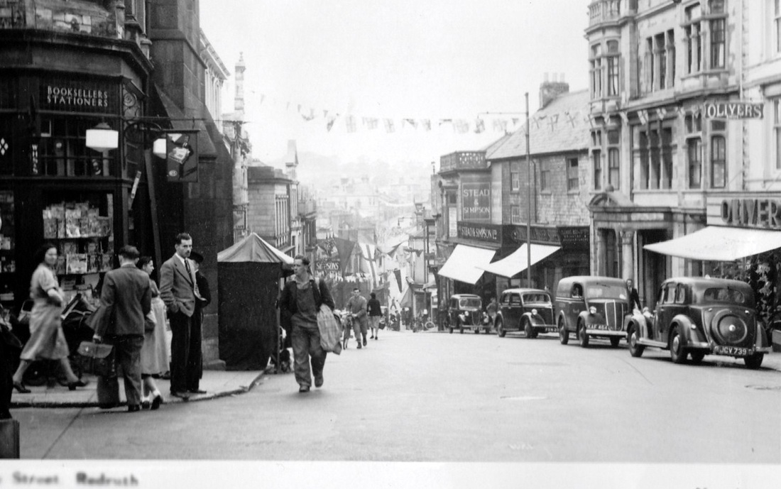
View is part of Fore Street ,Redruth , in 1952.
Comparing the photo with a location on Google Maps ( below) , it seems it is now a pedestrian mall named Alma Place.
Comparing the photo with a location on Google Maps ( below) , it seems it is now a pedestrian mall named Alma Place.
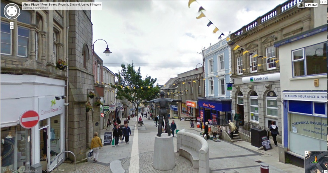
A feature of Alma Place is a two metres tall bronze statue of a Cornish miner. The statue design was selected by public vote and the town's Mining Art Group from among 70 submitted by artists who responded to press advertisments in 2006. It honours the men who worked in the district's tin and copper mines over the years.
The work, by David Annand, depicts a miner standing holding a pole pick , with a fan of candles around his neck,and wearing a helmet and a candle on his head. The era of mining by candlelight was chosen by Annand because he believes it has a more Cornish "feel" than mining using carbide, Davey or battery lamps.
The work, by David Annand, depicts a miner standing holding a pole pick , with a fan of candles around his neck,and wearing a helmet and a candle on his head. The era of mining by candlelight was chosen by Annand because he believes it has a more Cornish "feel" than mining using carbide, Davey or battery lamps.
Gwennap Pit, Redruth, Cornwall
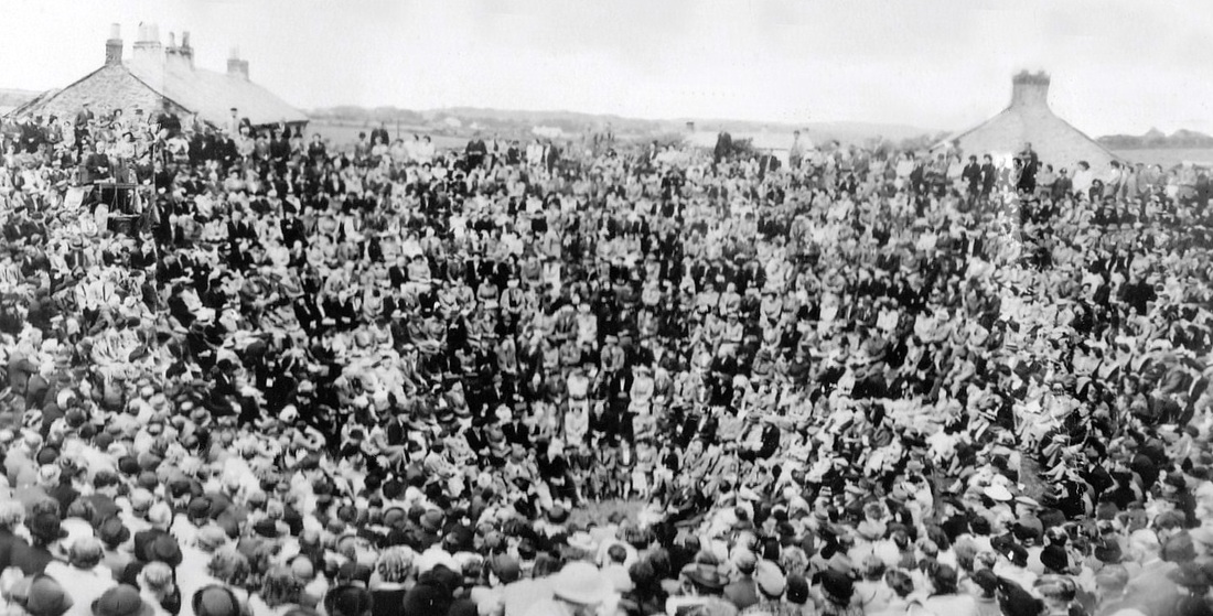
A hollow in the ground near Redruth, the pit may have resulted from mining activity.
It became famous as a preaching site by one of Methodism's founders, John Wesley.
He preached at the pit 18 times between 1762 and 1789.
Gwennap Pit has amazing acoustic properties and is used for a range of functions. These include church services, musical performances, drama presentations and weddings.
Since 1807 it has been the venue for an annual WhitSunday Methodist Rally.
The pit is owned by the Methodist Church and is a listed World Heritage Site.
St Michael's Mount
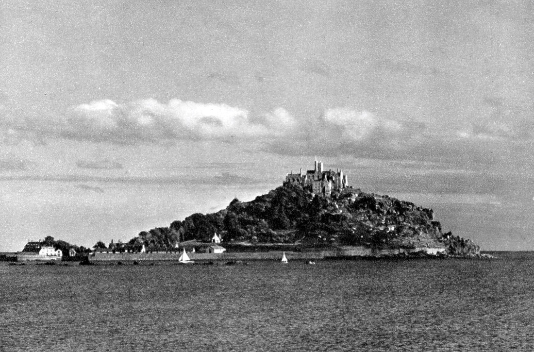
The Mount lies 366 metres (1200 feet) off the Cornish coast near the town of Marazion.
The island and its fortress-like abbey are accessible to visitors by foot using a man-made causeway at mid to low tides.The tower and battlements of the castle reach a height of 70 metres (230 feet). The castle was built in the twelfth century .
The causeway was once used by pilgrimsto a Benedictine abbey established in 1044. Their pilgrimages were encouraged by an indulgence granted by Pope Gregory.
The island had been a flourishing sea port after the harbour was improved in 1727. Its peak population was reached n 1821, when it had 221 residents. However it went into decline when nearby Penzance Harbour was upgraded and the railway arrived at Penzance in 1852.
The Lizard
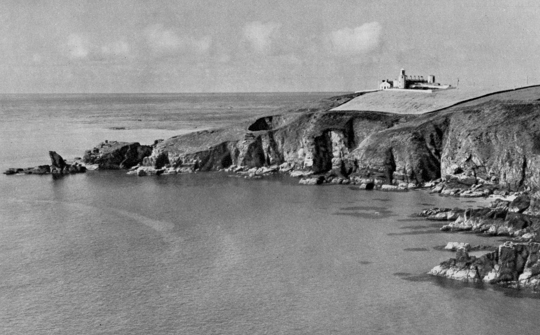
Lizard Point in Cornwall is the southernmost location on the mainland of Great Britain. There has been a lighthouse on Lizard Point since 1751, to warn seafarers of the treacherous Cornish coast.
Penzance
Penzance is the main commercial centre for the Land's End Peninsula and is the most westerly town in Cornwall.
Penzance , meaning "holy headland" in the Cornish language, refers to the location of a chapel now called St Anthony's ,that is said to have stood over 1000 ago on the headland near what became Penzance Harbour.
Penzance , meaning "holy headland" in the Cornish language, refers to the location of a chapel now called St Anthony's ,that is said to have stood over 1000 ago on the headland near what became Penzance Harbour.
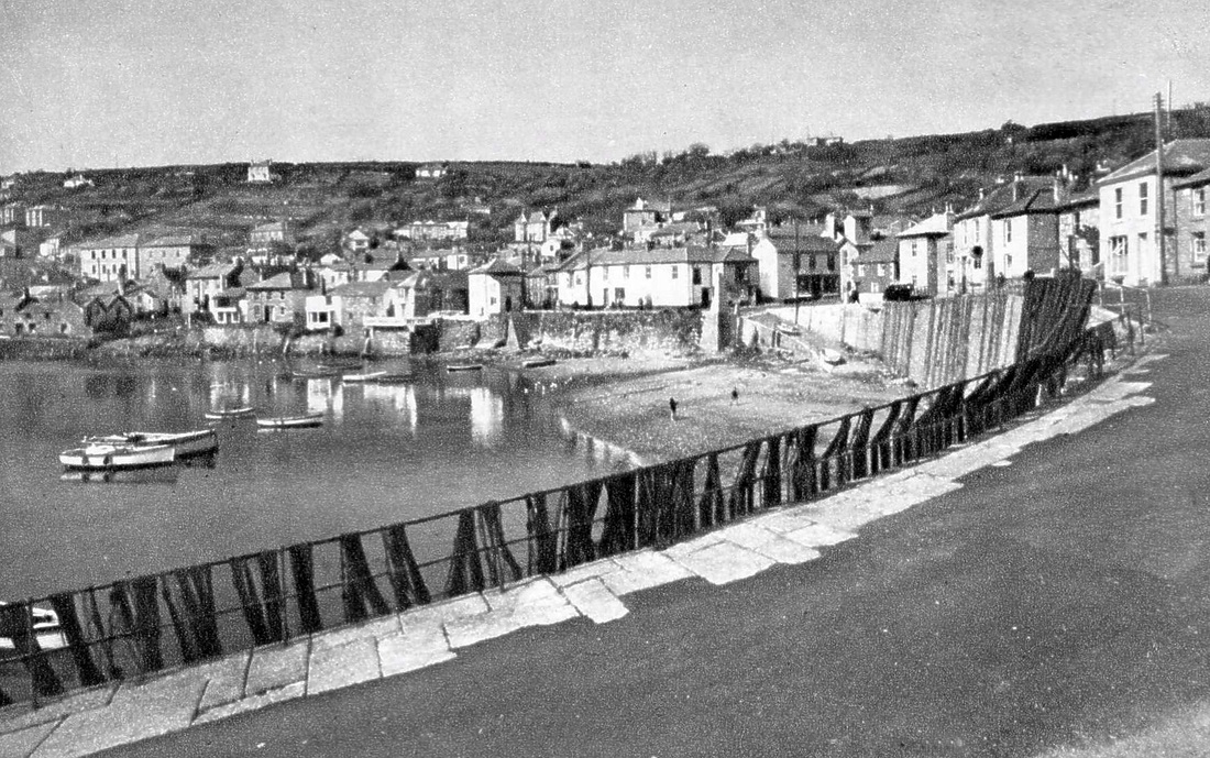
St Ives
St Ives has been a busy fishing port since the Middle Ages, and the site was inhabited as early as the Bronze Age.
Polperro
The old fishing village of Polperro was notorious for the smuggling activities of many of its residents in the 18th and early 19th centuries.The narrow streets have meant that cars are now banned from the village, making it ideal for visitors to explore its attractions on foot.
Mevagissey
The first record of the village dates from 1313, but like many places in Cornwall, the site was occupied as far back as the Bronze Age.
The attractive old town was once the centre of Cornwall's pilchard fishing industry.
It still has a small working harbour, and the village has a tradition of boat building dating from 1747.
Mousehole
This picturesque village was a busy fishing port 100 years ago. Now tourism is its major industry as visitors enjoy Mousehole's old world charm.
A Spanish raiding party sacked Mousehole in July 1595. Every dwelling, bar one, was razed to the ground. That sole survivor can still be seen today.
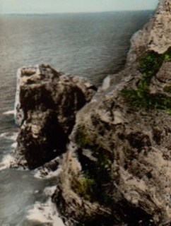
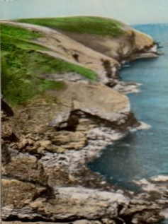
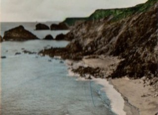
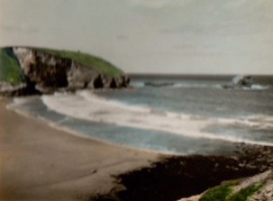
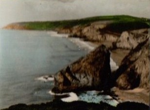
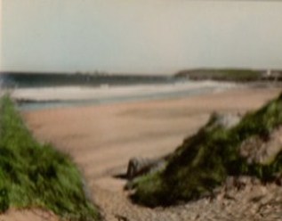
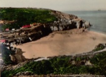
North Coast, Cornwall
The views below are from a small souvenire booklet,
HELL'S MOUTH & NORTH CLIFFS,CORNWALL,
purchased in Cornwall in 1952.
It contains 10 black and white photos of the Cornish coast which have been hand tinted, and bound together with a plastic spring binder.
The pages measure 8cm x 6cm ( 3 &1/8 inches x 2 & 3/8 inches)
HELL'S MOUTH & NORTH CLIFFS,CORNWALL,
purchased in Cornwall in 1952.
It contains 10 black and white photos of the Cornish coast which have been hand tinted, and bound together with a plastic spring binder.
The pages measure 8cm x 6cm ( 3 &1/8 inches x 2 & 3/8 inches)
|
|
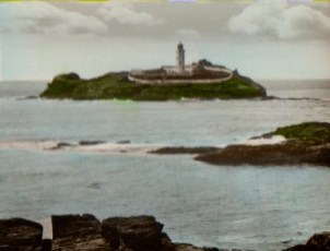
Fisherman's Cove Godrevy Lighthouse, Gwithian
|
|
Hell's Mouth Fisherman's Cove & Navax Point
|
|
Gwithian Church The North Cliffs From Deadman's Cave
|
|
Western Cliffs and Gull Rocks, Portreath Toban Rock, Porthtowan
|
|
The Sands from The Towans, Gwithian Trevaunance Cove, St. Agnes
Barnstaple, Devon
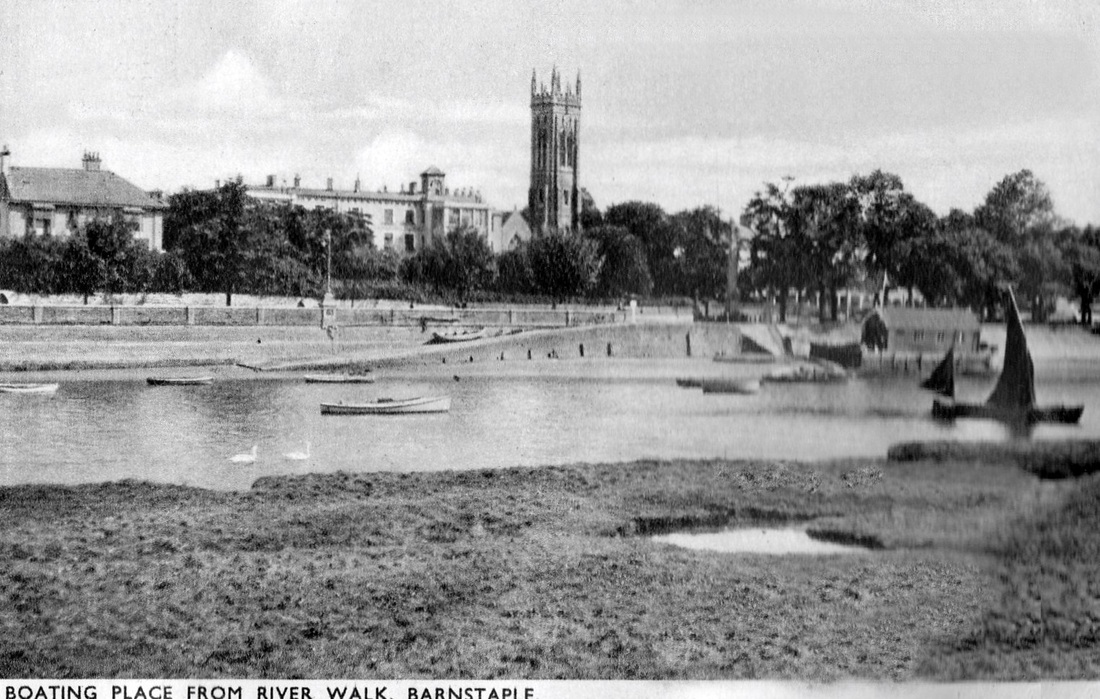
Barnstaple has been the major market town for North Devon since Saxon times.
It was founded at the lowest crossing point of the River Taw, about 3 miles (5 km) from the Taw's seafall at the Bristol Channel.
The town's name is first recorded in the 10th century and derives from the Old English bearde, meaning "battle-axe", and stapol, meaning "pillar", referring to a post or pillar set up to mark a religious or administrative meeting place.
By the time of the Domesday Book, Barnstaple had its own mint.
Its wealth in the Middle Ages was based on it being a staple port licensed to export wool.
Bath Abbey,Somerset.
Now an Anglican parish church, Bath Abbey was a former Benedictine monastery which was founded in 675.
Bath Abbey was reorganised in the 10th century and rebuilt in the 12th and 16th centuries. Major restoration work was also carried out in the 1860s.
The church has a cruciform plan and is built in a perpendicular Gothic style.
The heritage listed church can seat 1200 people.It has two organs and a peal of ten bells.
The west front seen in this photo has two stone sculptures of angels climbing to heaven on Jacob's Ladder.
Rockford, Devon
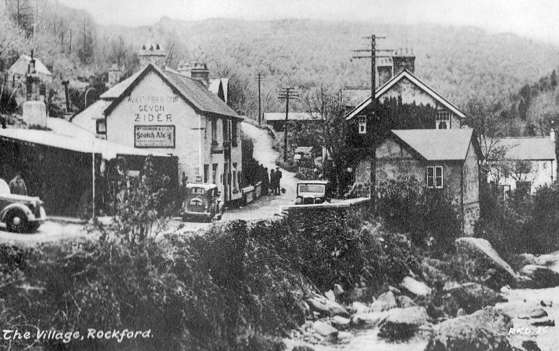
The small hamlet of Rockford is located within the Exmoor National Park, in Devon.
The town's pub, seen in this picture, dates from the 1600s. It still offers home brewed ale, and traditional hospitality.
The village dwellings could not be any closer to the East Lyn River, which rushes from Exmoor to the sea at Lynmouth ,some 6.5 kilometres (4 miles) further downstream.
The town's pub, seen in this picture, dates from the 1600s. It still offers home brewed ale, and traditional hospitality.
The village dwellings could not be any closer to the East Lyn River, which rushes from Exmoor to the sea at Lynmouth ,some 6.5 kilometres (4 miles) further downstream.
Market House, Tetbury, Gloucestershire
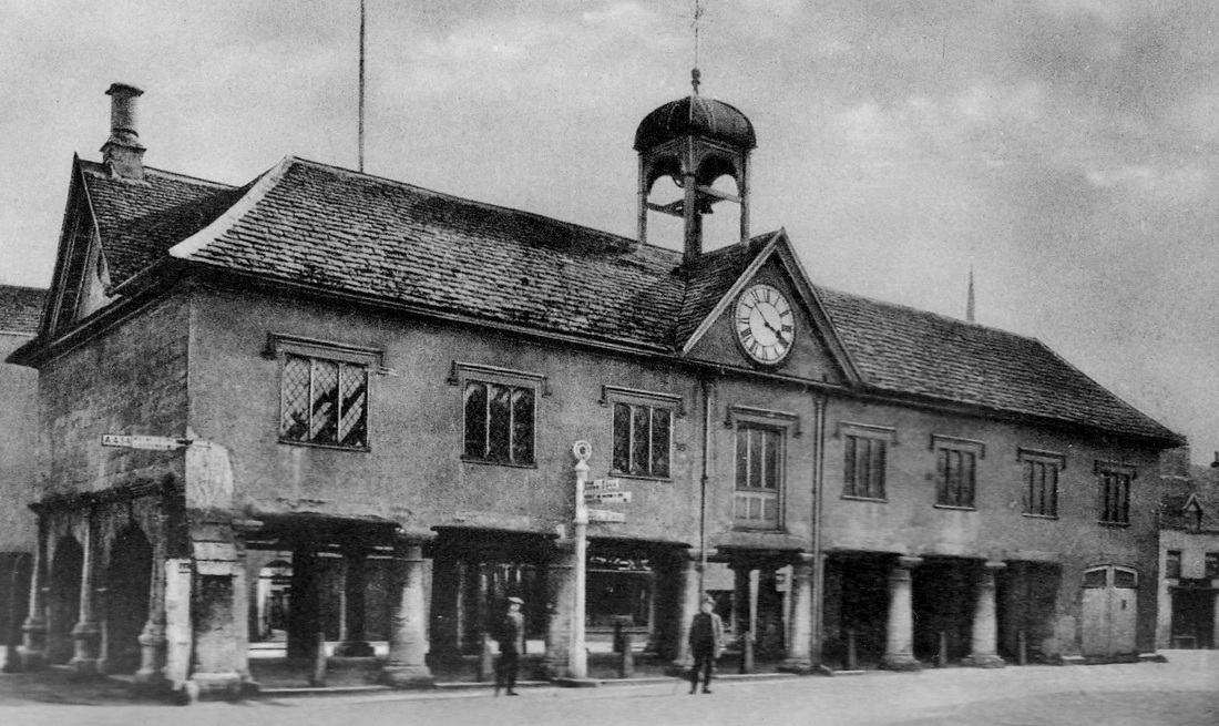
The Cotswold town of Tetbury in Gloucestershire is on the site of an ancient hill fort, on which an Anglo-Saxon monastery was founded in 681.
In the Middle Ages, Tetbury became an important market for Cotswold wool and yarn.
Notable buildings in the town include the Market House,shown here, which was built in 1655.
Tetbury also has many houses which belonged to prosperous wool merchants , giving parts of the town a similar look to how it was over 300 years ago.
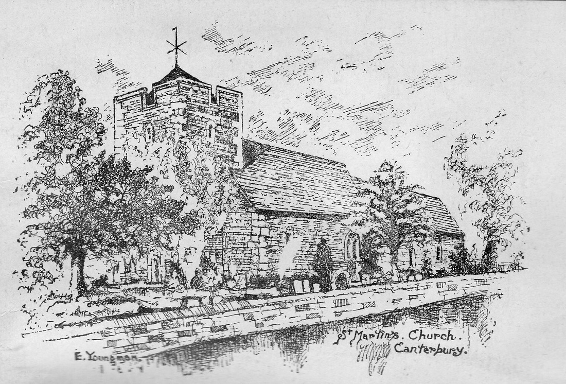
St. Martin's Church, Canterbury
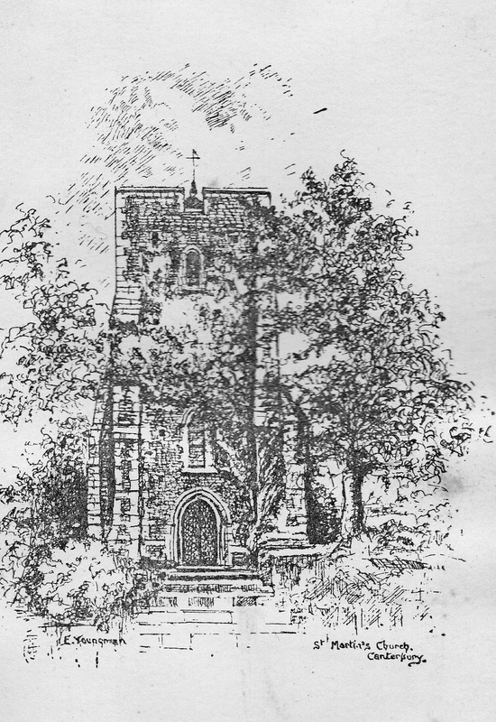
Above and below: Two postcards with black and white drawings of St. Martin's.
The Church of St Martin, Canterbury, is the oldest Church in the English speaking world still in continuous use for worship. It has been used for weekly services since 1668.
St Martin's was the private chapel of Queen Bertha of Kent in the 6th century.
This was before St. Augustine set up his mission in Canterbury when he arrived from Rome in 597 to convert the English. Queen Bertha was a Christian Frankish princess who arrived in England with her Chaplain, Bishop Liudhard.
King Æthelberht of Kent, her pagan husband , allowed her to continue to practise her religion in an existing church which had been in use in the late Roman period but had fallen into disuse. This was probably St Martin's. The church contains many reused Roman bricks , as well as complete sections of walls of Roman tiles.
Canterbury Cathedral
Postcard watercolour print of Canterbury Cathedral.
Canterbury Cathedral in Canterbury, Kent, is the cathedral of the Archbishop of Canterbury, leader of the Church of England and symbolic leader of the worldwide Anglican Communion.
The cathedral's first archbishop was Augustine of Canterbury, previously abbot of St. Andrew's Benedictine Abbey in Rome. He was sent by Pope Gregory the Great in 596 as a missionary to the Anglo-Saxons.
Augustine founded the cathedral in 597.
Over the centuries, the cathedral has undergone several building and rebuilding stages to result in its present appearance.
While some people may think that terrorism is a relatively new phenomenon, an event in 1011 suggests otherwise.
That year, the cathedral was badly damaged during Danish raids on Canterbury. The Archbishop, Alphege, was held hostage by the raiders and eventually killed at Greenwich on 19 April 1012.
Hadrian's Wall ,Northumberland.
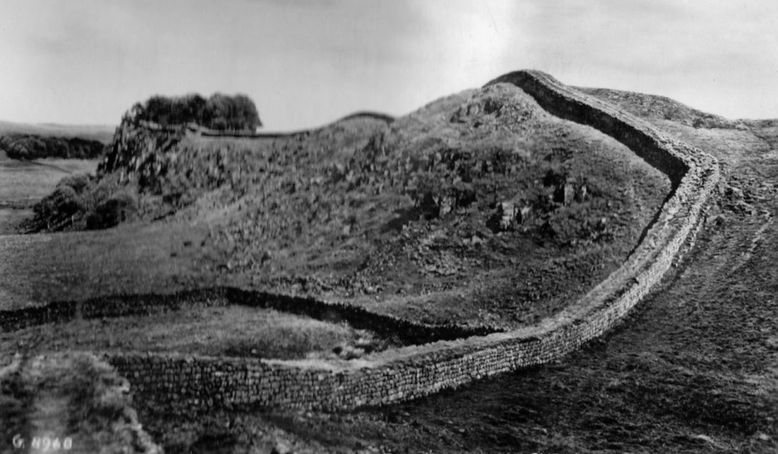
A section of Hadrian's Wall at Housesteads, Northumberland.
Hadrian's Wall was a defensive fortification across the north of Roman Britain.
It was 80 Roman miles (73 modern miles or 120 km) long, from the North Sea to the Irish Sea.
The width and height depended on the construction materials which were available nearby.It ranged from 2.4metres to 3 metres (8-10 feet) wide, and 4.5 metres (15 feet) high.
Begun in 122, during the rule of emperor Hadrian, it was largely completed within six years.
After Roman forces withdrew from Britain in 410 the garrisons along the wall are thought to have been composed of local Britons who had nowhere to go. Some probably lingered for generations, and there's evidence of parts of the wall still being occupied well into the 5th century.
Much of the wall still remains , particularly the mid-section, and for a considerable length the wall can be followed on foot and by bicyle.
It has been a listed World Heritage Site since 1987.
Prince Charlies Monument, Scotland
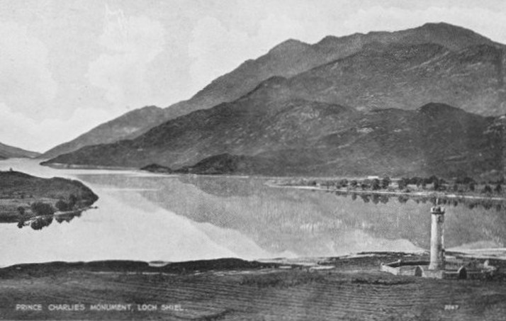
The Glenfinnan Monument situated here at the head of Loch Shiel was erected in 1815 to mark the place where Prince Charles Edward Stuart ("Bonnie Prince Charlie") raised his standard, at the beginning of the 1745 Jacobite Rising.
Oban, Scotland.
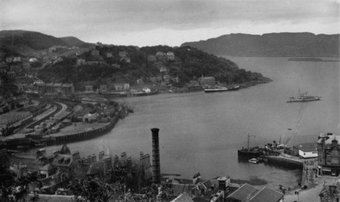
Oban is a resort town in the council area of Argyll and Bute, Scotland.
The town occupies a beautiful setting in the Firth of Lorn.
Oban Bay is a near perfect horseshoe bay, protected by the island of Kerrera.
In the 18th century, the land on which Oban now stands supported very few households, with industries being only minor boatbuilding and quarrying.
The modern town of Oban grew up around the distillery that was founded there in 1794.
By the late 1800s, it was a busy port which shipped wool, whisky, slate and kelp to Liverpool and Glasgow.
The arrival of the railways created a new prosperity , revitalising local industry and giving birth to local tourism.
Some 9.4% of Oban's population speak Gaelic.
Inverness, Scotland
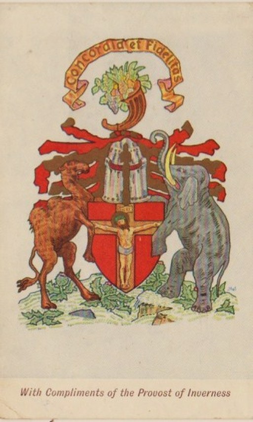
This postcard was obtained in Inverness in July 1952.
It shows a Royal Burgh coat of arms, which were granted in 1900.
The arms include a depiction of Jesus on the Cross, believed to relate to a side-altar of the Holy Cross in the local parish church before the Reformation.
The image appeared on the seal of Inverness since as early as 1439.
The camel and elephant supporters indicate the importance of overseas trading to the history of Inverness. The Latin words "Honesty and Harmony" are above the Coat of Arms.
With changes to legislation in 1975, a Highland Council replaced the local management of Inverness, and the coat of arms was therefore lost.
Inverness was awarded its charter as a Royal Burgh in 1158 by King David of Scotland. But it was 2001 before the burgh was awarded the status of "city" by the Queen.
In January 2008 a petition to obtain a coat of arms for the City of Inverness was refused by the Lord Lyon King of Arms, who is the heraldic authority in Scotland, on the grounds that there was no legal body to which arms could be granted.
An appeal has been lodged on that decision, but the result is not known to the writer in 2012.
Macdonald Monument, Glencoe, Scotland.
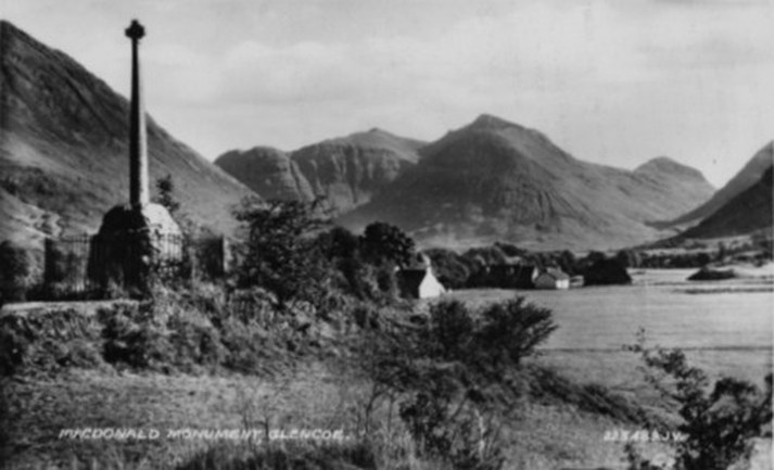
Early in the morning of 13 February 1692,a massacre took place in Glen Coe, in the Highlands of Scotland.
This incident is referred to as the Massacre of Glencoe.
The massacre started at 5am ,following orders received the previous night, that all MacDonalds under seventy years of age were to be killed on the grounds that the MacDonalds had not been prompt enough in pledging allegiance to the new monarchs, William and Mary.
Captain Robert Campbell ,who was in charge of the operation, had asked the Macdonalds for quarters for his 130 soldiers and, unaware of what was planned, the MacDonalds had entertained them for 10 days.
The soldiers rose from their beds and set about the massacre of their hosts, with whom they had been living on friendly terms.
It was this act of treachery in response to hospitality that makes the massacre such a heinous crime.
Although only forty were killed, many more escaped to the hills only to die of hunger and exposure. Forty women and children died of exposure after their homes were burned.
A monument to the fallen MacDonalds was erected by clan descendants in 1883 in Glencoe village.
Since 1930 there's been an annual wreath laying ceremony at the memorial on the anniversary of the Massacre . It's attended by members of Clan Donald from across the world, along with local people.
Burns' Cottage, Alloway, Scotland.
Robert Burns, known in his native Scotland as "The Bard", is also known around the world as Rabbie Burns, Scotland's favourite son, the Ploughman Poet, Robden of Solway Firth, and the Bard of Ayrshire .
The poet and lyricist was born in the cottage shown in this watercolour postcard on 25 January 1759.
His father had built the cottage at Alloway about 3km (2 miles ) from the town of Ayr.
The eldest of seven children, he lived in the family cottage until Easter 1776 when he was seven years of age.
Burns' poem (and song) Auld Lang Syne is perhaps his best known composition, being sung around the world on special occasions.
He had poor health and aged prematurely.
He died on 21 July 1796 at the age of 37.
Through his twelve children, Robert Burns has over 600 living descendents as of 2012, according to Wikipedia.
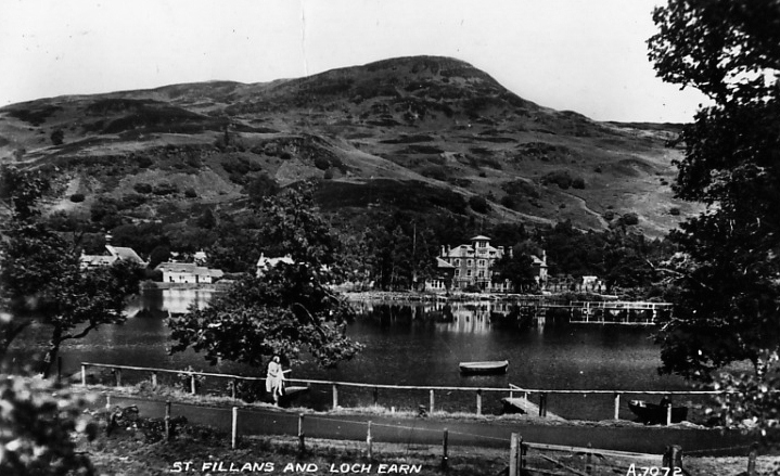
St. Fillans, Scotland
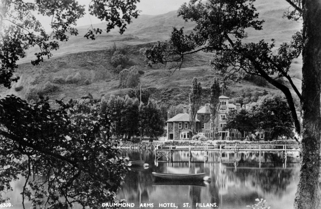
According to Historic Scotland, which has listed the hotel and its outbuildings, The Drummond Arms Hotel is by far the most prominent building in the central highlands village of St Fillans, in the district of Perth and Kinross, Scotland. It towers above neighbouring buildings and provides a focus for the village, especially when seen from the road approaches to the village and across Loch Earn.
It has evolved from a small inn in 1817 through a series of renovations and extensions to its present stature.
The hotel has played a significant role in the development of tourism in the Loch Earn area.
Below: Another postcard view of St. Fillans and Loch Earn.
It has evolved from a small inn in 1817 through a series of renovations and extensions to its present stature.
The hotel has played a significant role in the development of tourism in the Loch Earn area.
Below: Another postcard view of St. Fillans and Loch Earn.
Loch Earn, Scotland
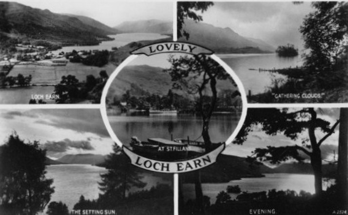
This postcard shows five views from around Lock Earn, a freshwater loch in the central highlands of Scotland.
Glen Nevis, Scotland
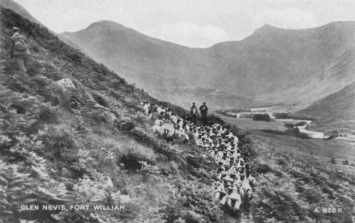
Glen Nevis is a glen in the Lochaber district of the Scottish Highlands, with the town of Fort William at its foot. To the north of the Glen are the highest mountains in the British Isles ...: Ben Nevis, Càrn Mor Dearg, Aonach Mòr, and Aonach Beag. It is also home to one of the three highest waterfalls in Scotland, Steall Falls, below which is a steep and impressive gorge.
Highland Cattle, Scotland
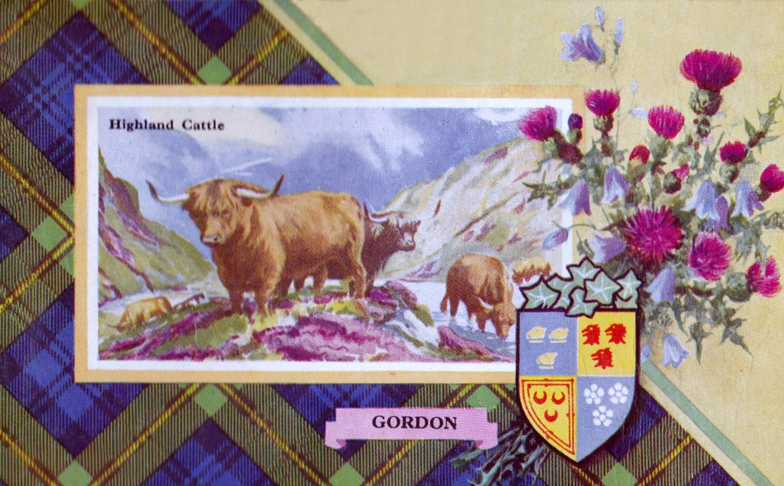
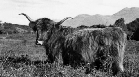
"Highland Beauty" Near Taynuilt, Argyll.
One of Britain's oldest , most distinctive, and best known breeds of cattle, the Highlander has remained largely unchanged over the centuries.
The extremely harsh conditions in the rugged Highlands and Western Isles of Scotland created a process of natural selection, where only the fittest animals survived to carry on the breed.
Written records go back to the 18th century and The Highland Cattle Herd Book, first published in 1885, lists pedigrees since that time.
Breeding stock has been exported to the rest of the world, especially Australia and North America, since the early 20th Century.
