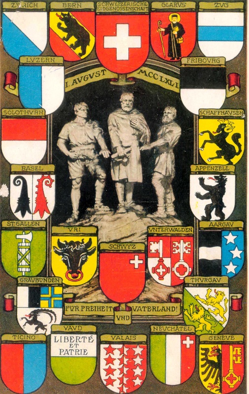
Postcard showing the coats of arms of the Swiss Cantons.
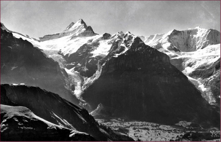
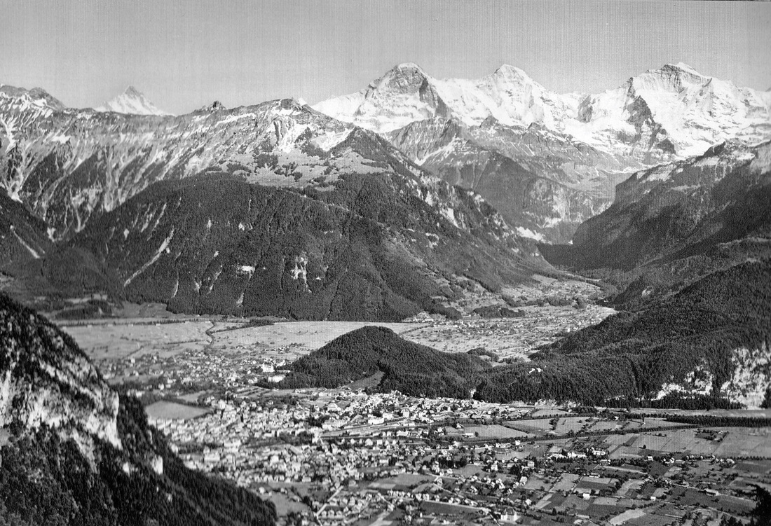
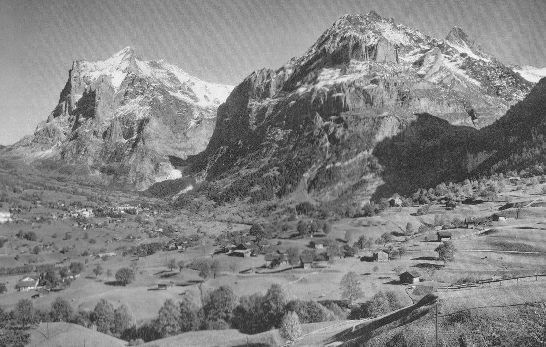
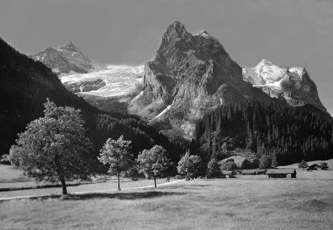
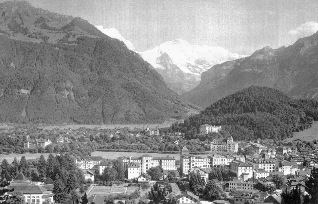
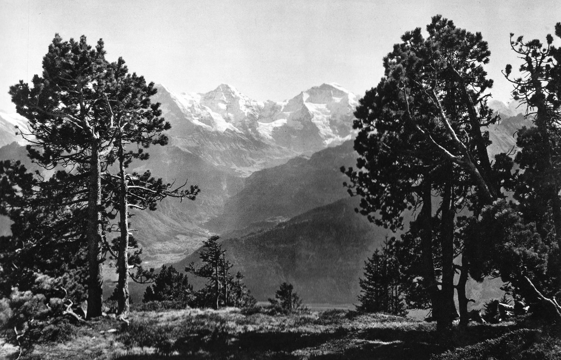
Grindlewald
Village of Grindlewald, Switzerland, below in the valley.
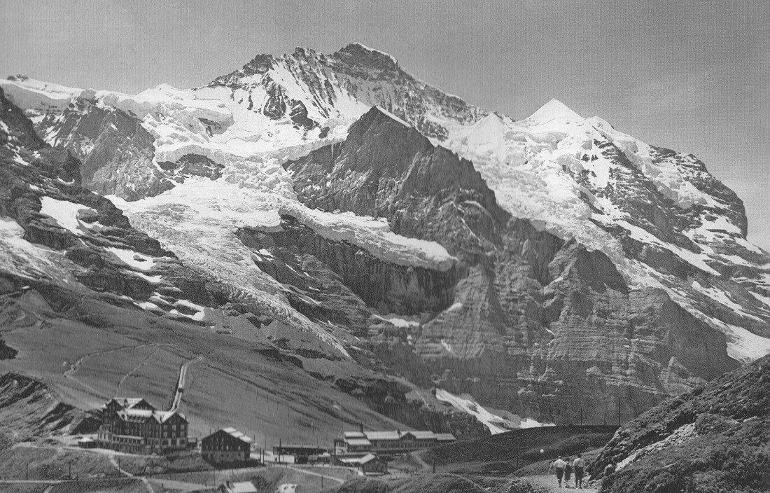
The village is a popular winter tourist town, offering skiing for all levels of ability. Also seen is the Eiger Mountain and Glacier together with other glaciers. The photo is taken from Bergstation, chair lift, First, Switzerland.
The village is a popular winter tourist town, offering skiing for all levels of ability. Also seen is the Eiger Mountain and Glacier together with other glaciers. The photo is taken from Bergstation, chair lift, First, Switzerland.
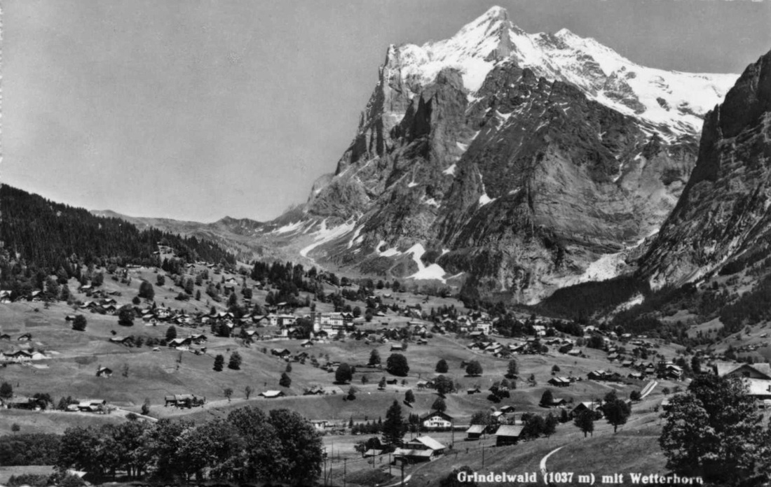
The village of Grindelwald with The Wetterhorn above.
The 3692 metre high mountain has three distinct peaks the Wetterhorn (most visible from Grindelwald), the Mittelhorn (the highest) and the Rosenhorn.
Winston Churchill is believed to have climbed the Wetterhorn in 1894.
The 3692 metre high mountain has three distinct peaks the Wetterhorn (most visible from Grindelwald), the Mittelhorn (the highest) and the Rosenhorn.
Winston Churchill is believed to have climbed the Wetterhorn in 1894.
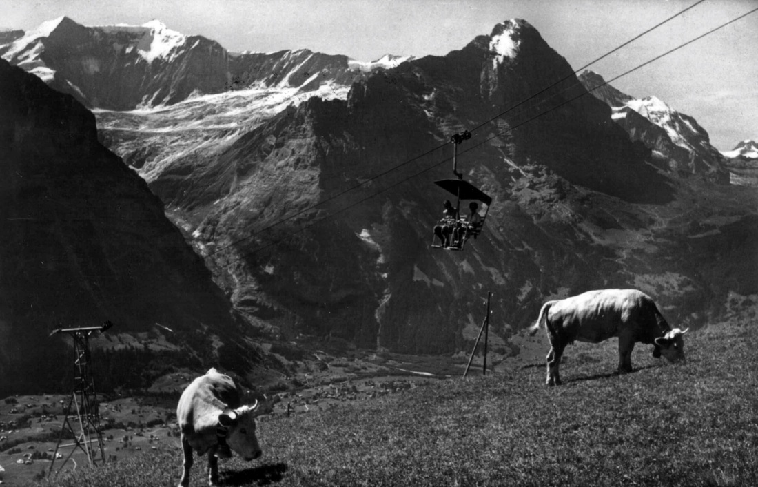
The chairlift from Grindlewald to First. Grindlewald down in the valley. Swiss cows with their bells.
Chateau de Chillon, Montreaux.
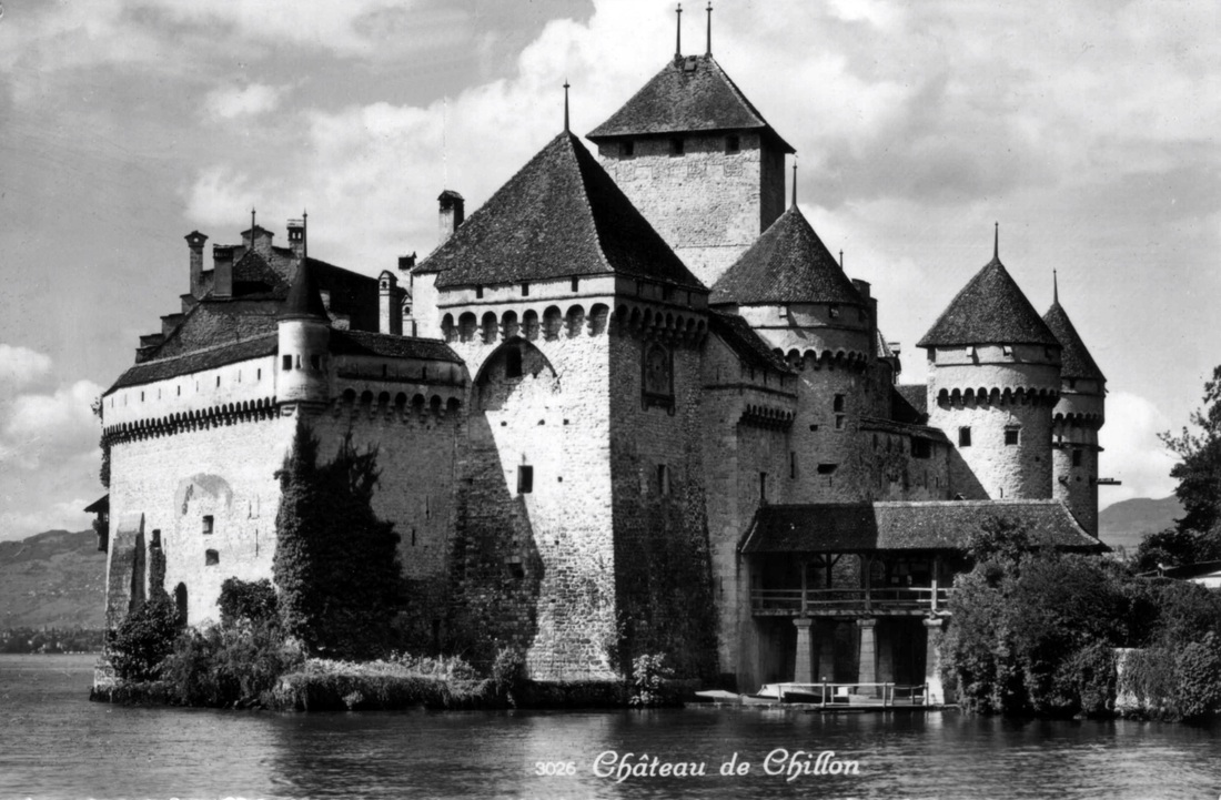
The Chateau de Chillon is located on the shore of Lake Geneva at its eastern end.
The castle consists of 100 separate buildings that were gradually connected to become the building as it stands now.
The oldest parts of the castle have not been positively dated, but the first written record is in 1160 or 1005.
From the mid 12th century, the castle was home to the Counts of Savoy, and it was greatly expanded in the 13th century.
The Castle was never taken by siege, but did change hands through treaties.
Famous British writer, Lord Byron, made the castle popular through his
poem The Prisoner Of Chillon (1816), about a monk who was imprisoned there for six years from 1530.
Byron also carved his name on a pillar of the castle’s dungeon.
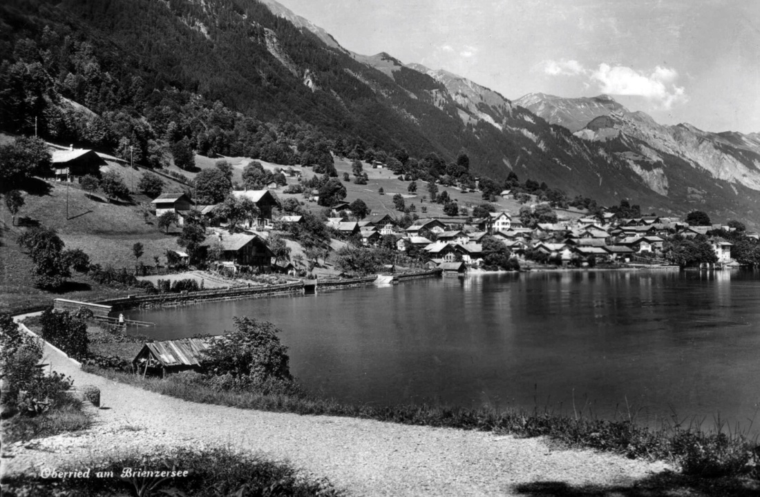
Oberried on Lake Brienze.
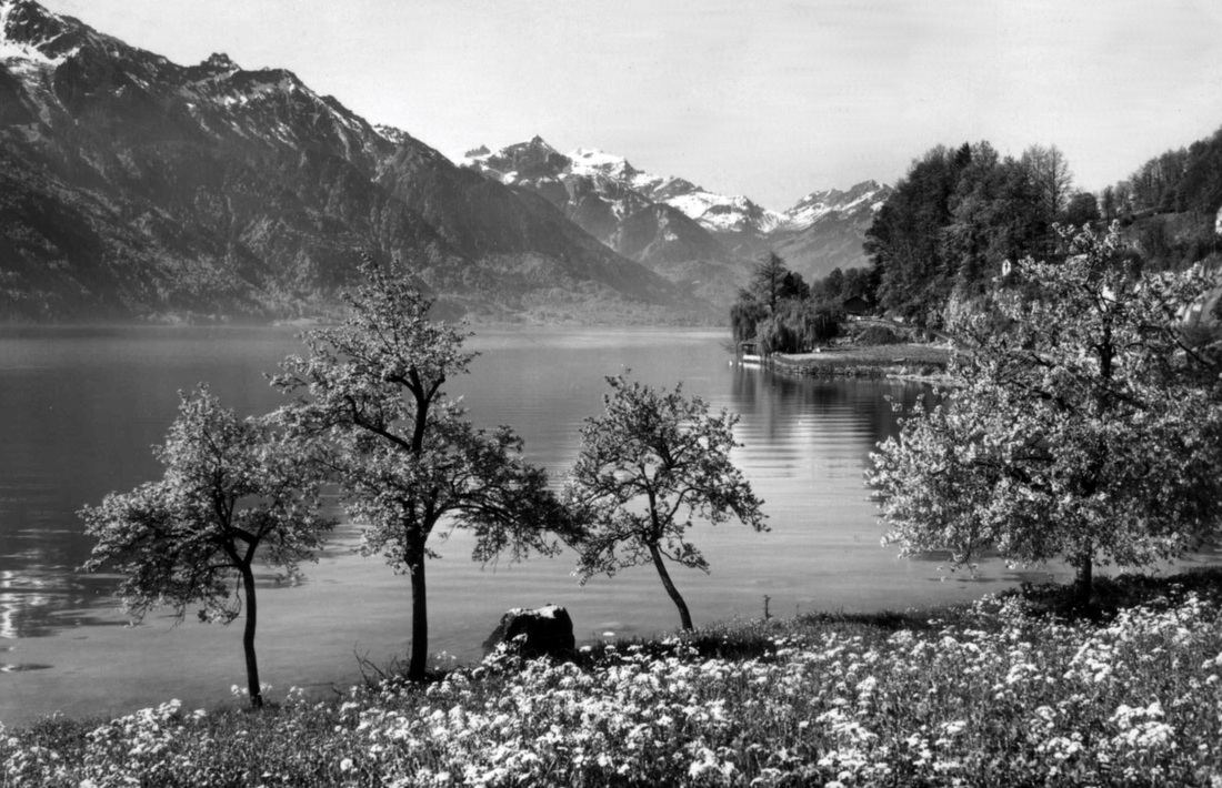
Above and below: Two views of Oberried.
Oberried village on the shore of Lake Brienze and the mountains behind. Oberried am Brienzersee is first mentioned in 1303.
There has been a fireworks factory in the village since 1863,
Oberried village on the shore of Lake Brienze and the mountains behind. Oberried am Brienzersee is first mentioned in 1303.
There has been a fireworks factory in the village since 1863,
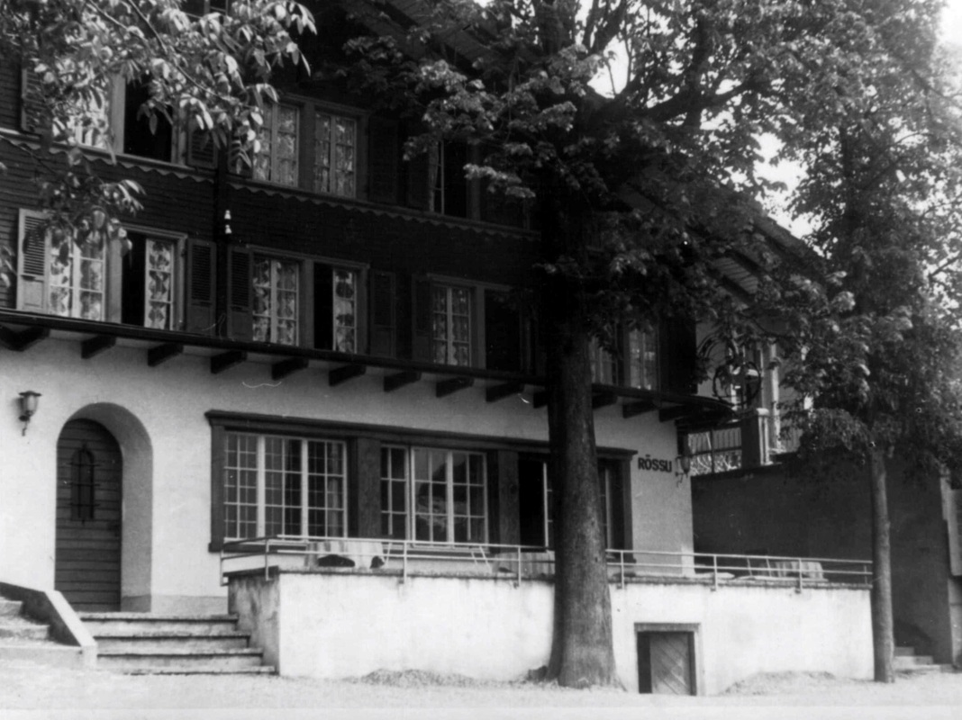
The Hotel Rossli, in Oberried.
Stanserhorn Mountain.
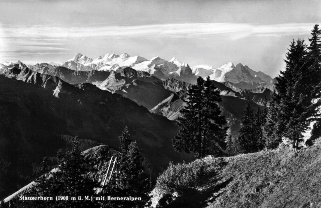
View from the 1900 metre high summit of Stanserhorn, across to the Bernese Alps.

A viewing platform on the summit of Stanserhorn mountain, 1900 meters above sea level.
In 1893 a funicular railway was built to transport people from the base of the mountain to the summit.
In the late 1970s the upper section of railway was replaced by a cable car.
Views extending as far as Elsace in France and The Black Forest in Germany, can be seen from the Stanserhorn summit.
In 1893 a funicular railway was built to transport people from the base of the mountain to the summit.
In the late 1970s the upper section of railway was replaced by a cable car.
Views extending as far as Elsace in France and The Black Forest in Germany, can be seen from the Stanserhorn summit.
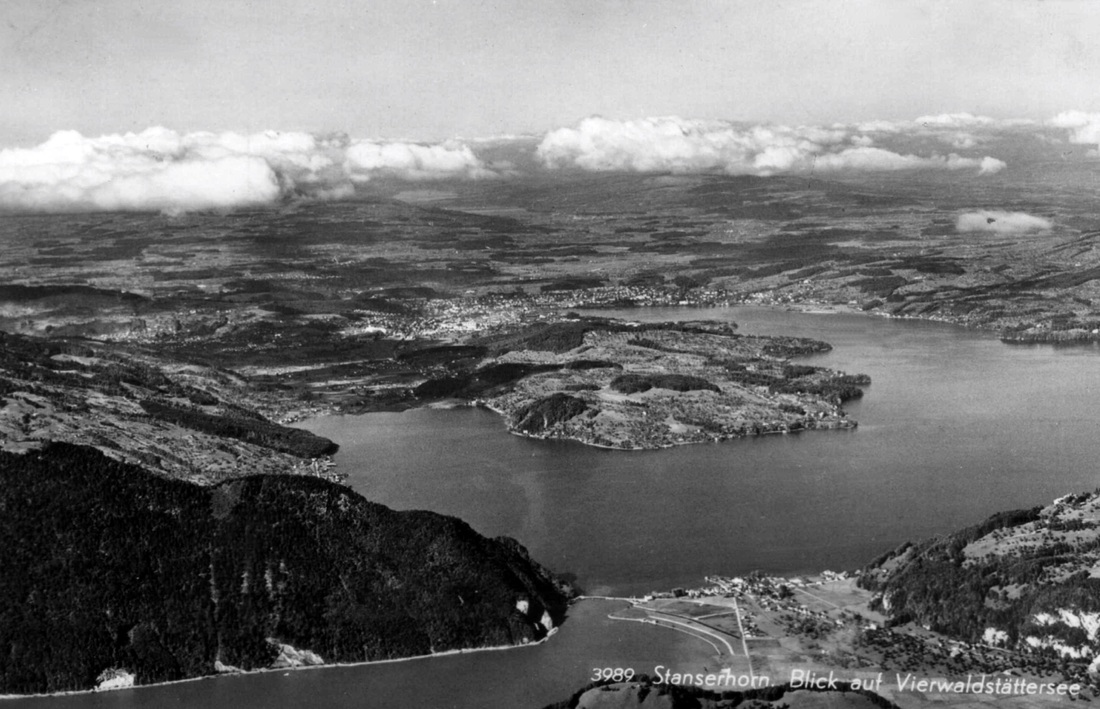
A view over parts of Lake Lucerne from the summit of Stanserhorn.
The city of Lucerne can be seen in the centre of the photo.
The city of Lucerne can be seen in the centre of the photo.
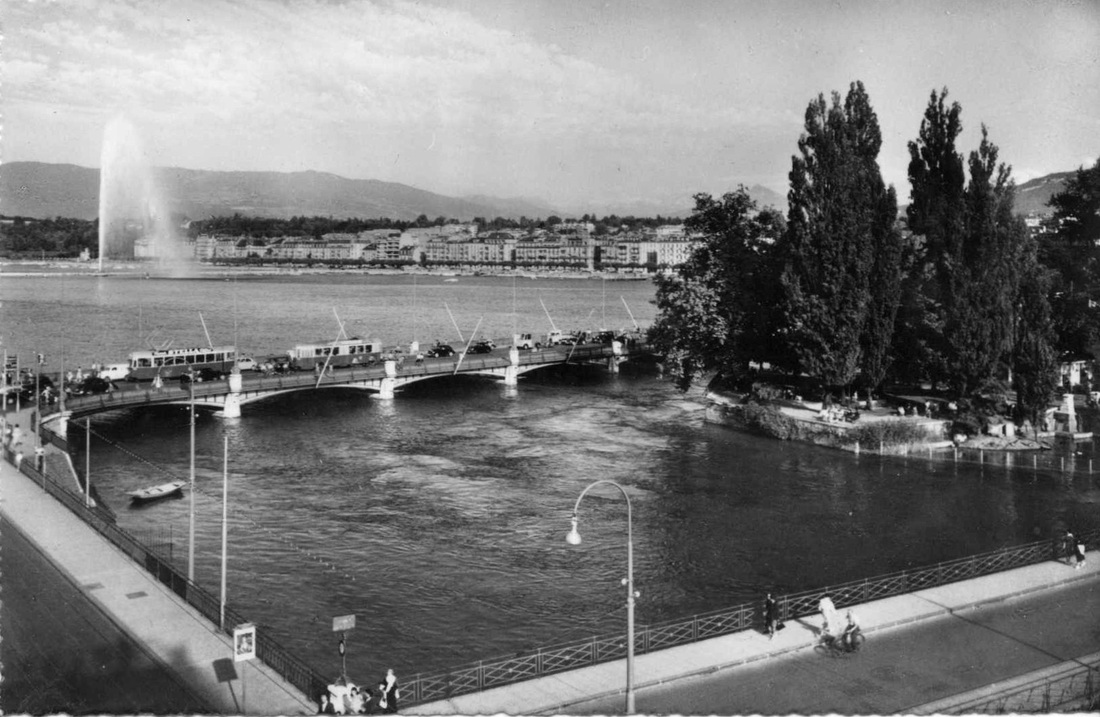
Jet d'Eau,Geneva
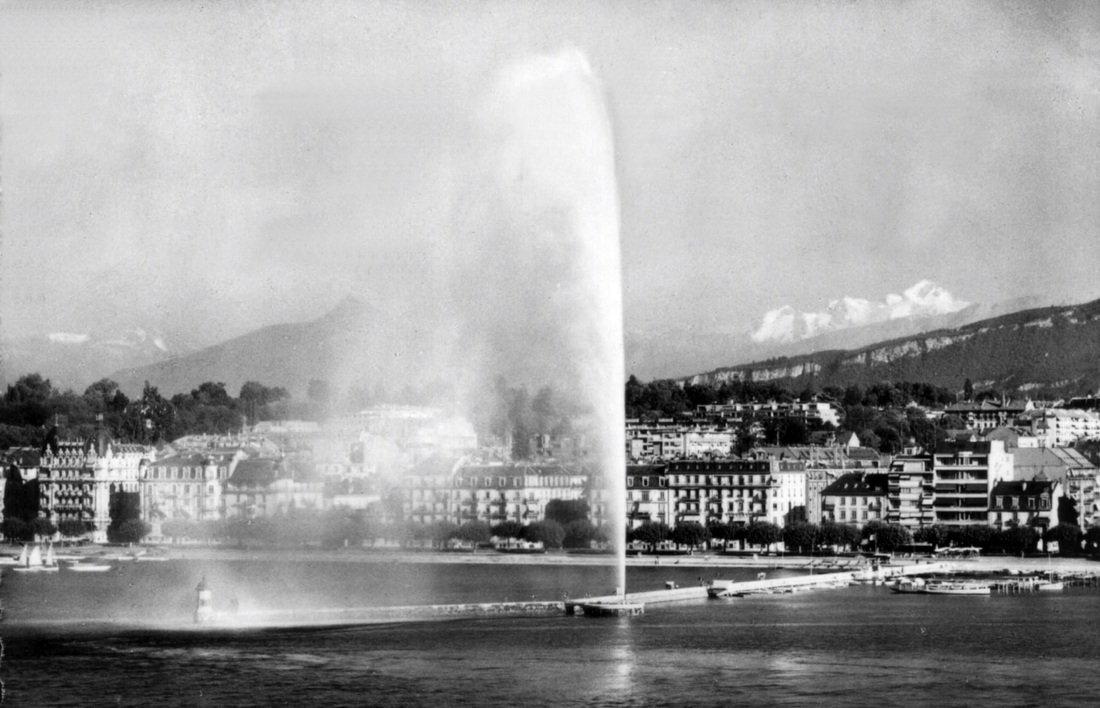
Above and below: Two views of The Jet d'Eau (Water-Jet) ,on Lake Geneva.
One of the largest fountains in the world., it is visible throughout Geneva and from the air, even from aircraft flying as high as 10 km (33,000 ft).
Five hundred litres (132 gallons) of water per second are jetted to a height of 140 metres (459 feet) by two electric pumps. The water leaves the nozzle at 200 km/h (124 mph). At any given moment, when it's operating, there are about 7000 litres (1850 gallons) of water in the air.
A Jet d'Eau was installed in 1886 a little further downstream from its present location.. It could reach a height of about 30 metres (98 feet).
In 1891 it was moved to its present location and its maximum height was increased to about 90 metres (295 feet).
The present fountain was installed in 1951, for the first time using lake water instead of city water.
Since 2003, the fountain has operated year round during daylight hours , except in frosty and windy conditions.
Illuminated by 12 floodlights, it also operates on spring, summer and autumn evenings.
Fluelin on Lake Lucerne
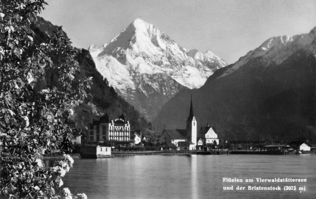
The village of Fluelin at the furthest end of Lake Lucerne.
Seen behind is the 3073 metre high Bristen Mountain which has an almost perfect pyramid shape.
Seen behind is the 3073 metre high Bristen Mountain which has an almost perfect pyramid shape.
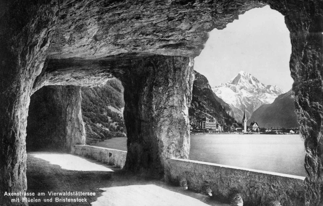
The village of Fluelin seen through a road tunnel "window".
Construction of the Axenstrasse (road), now a world-class tourist attraction, was started in 1860 and the first section was opened five years later. The road improved communications in Central Switzerland and gave land access for the first time to the St. Gotthard mountain pass.
Due to almost vertical rock faces near the village of Fluelen, some sections of the road were created as tunnels blasted through rock. Many openings were made in the tunnel wall giving delightful views framed by these “windows”.
The road has been altered in recent times and the tunnel section shown in the postcard has been closed to traffic. It is now available for use by hikers.
|
|
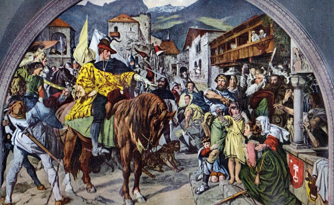
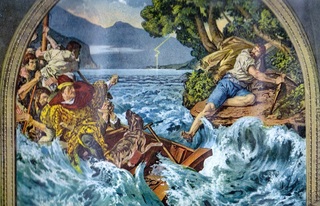
The above postcards depict scenes involving the folk hero William Tell.
At left, he refuses to bow to Gessler, a brutal Hapsburg bailiff in the village square of Altdorf.
After being taken into custody Tell escapes from the boat in which he is being transported ( right postcard). He clambers up a flat rock on the shore of Lake Lucerne. The rock (the Tellsplatte) is located about 3km from Fluelin.
Tell's defiance sparked a rebellion which eventually resulted in the formation of the independent Swiss Confederacy.
Castagnola
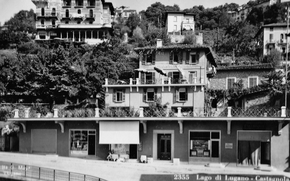
Buildings on the shore of Lake Lugano, at Castagnola, near the city of Lugano.
A reference to Castagnola has been found from as long ago as 1335.
Until 1972 it was a separate municipality.But that year it became part of Lugarno.
The border between Switzerland and Italy cuts across Lake Lugano in several places.
A reference to Castagnola has been found from as long ago as 1335.
Until 1972 it was a separate municipality.But that year it became part of Lugarno.
The border between Switzerland and Italy cuts across Lake Lugano in several places.
Swiss cows near Zurich
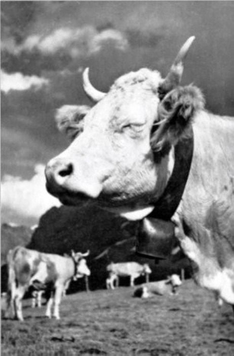
A bovine scene in the Alps at Mittagsrast, near Zurich
Brown Swiss or Braunvieh cattle are widely regarded as the oldest of all dairy breeds.
The cows were developed in the north-eastern part of Switzerland.
There's evidence that Benedictine monks at the Einsiedeln Monastery in Switzerland started breeding these cattle at least 1000 years ago.
Bones found in sites occupied by early Swiss lake dwellers probably date back 6000 years, and resemble skeletons of today's Brown Swiss cow.
Cowbells are attached to the animals so that the freely roaming livestock don't wander from Alpine summer pastures without the owners knowing.
They've been used for at least 800 years.
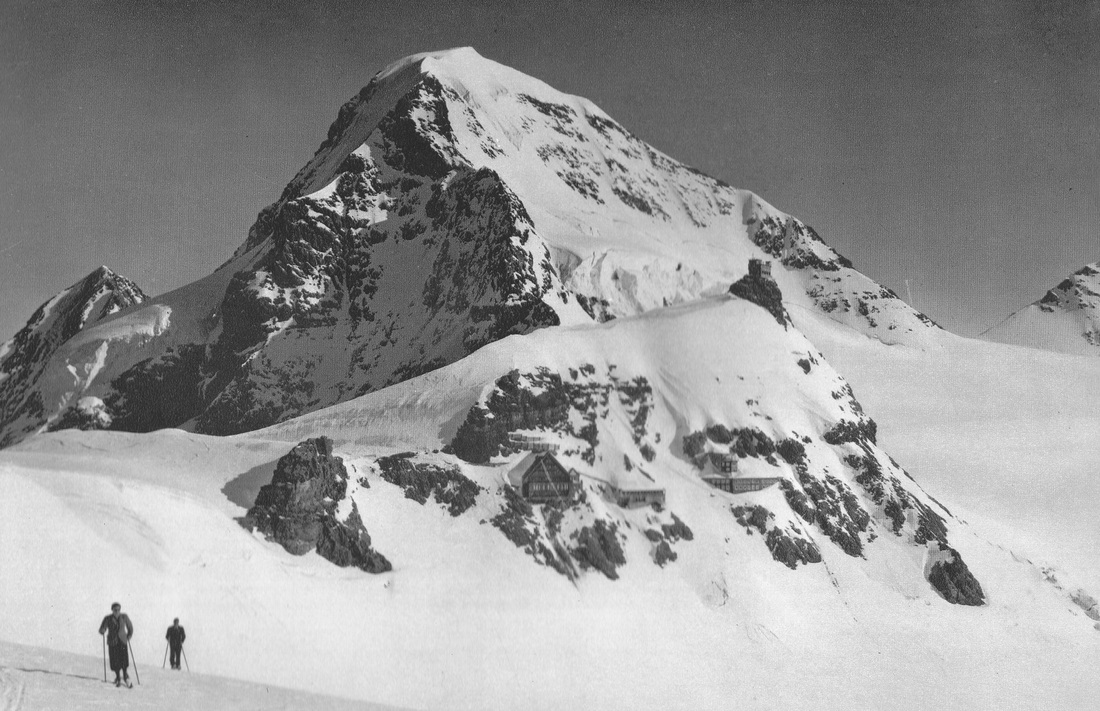
The views below are from a souvenire booklet presented with the compliments of the Official Inquiry Office, Interlaken,1952
|
|
(L)Jungfrau 3475 metres ( 11,401 ft) and the Sphinx 3573 metres (11,723 ft)
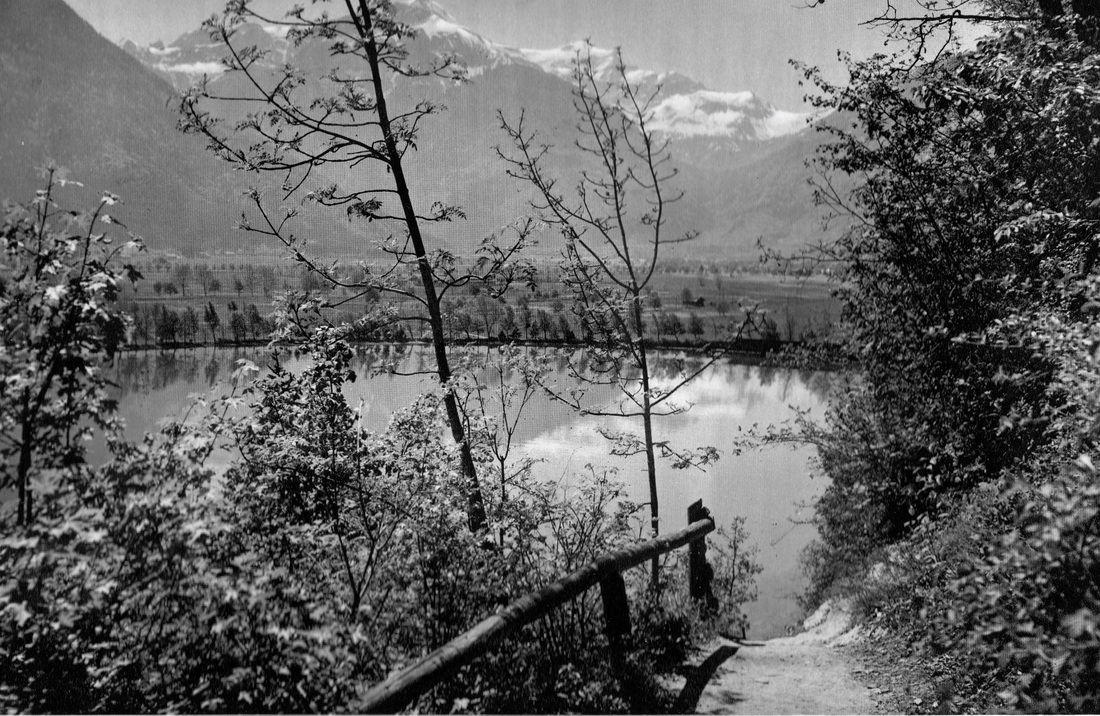
(R) Beside Lake Brienz
(R) Beside Lake Brienz
|
|
(L) Interlaken from the Harder 1322 metres ( 4337 ft)
(R) Iseltwald beside Lake Brienz
(R) Iseltwald beside Lake Brienz
|
|
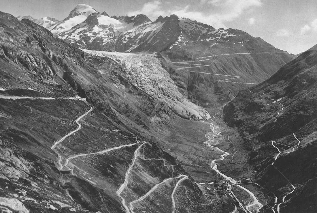
(L)The Grimsel Pass, Furka Pass and the Rhone Glacier
(R)The Eiger, Monch and Jungfrau
(R)The Eiger, Monch and Jungfrau
|
|
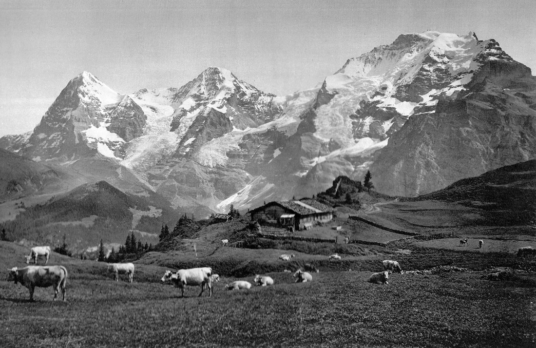
(L) Grindelwald Village with Wetterhorn, Mettenberg and Schreckhorn
(R) Little Scheidegg Mountain 2061 metres (6762 ft)
(R) Little Scheidegg Mountain 2061 metres (6762 ft)
|
|
(L) The Rosenlaui
(R) Lakes Thun and Brienz seen from Niesen Mountain 2362 metres ( 7749 ft)
(R) Lakes Thun and Brienz seen from Niesen Mountain 2362 metres ( 7749 ft)
|
|
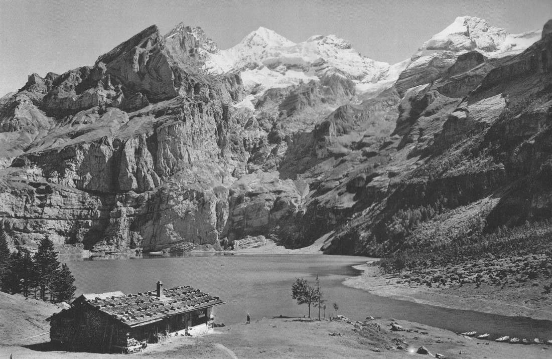
(L) Lake Oeschinen , near Kanderstag
(R) The Jungfrau
(R) The Jungfrau
|
|
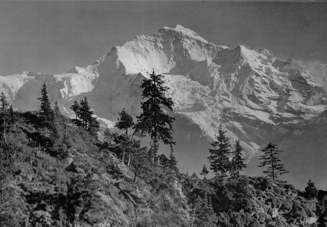
(L)The Jungfrau 4158 metres (13,642 ft)
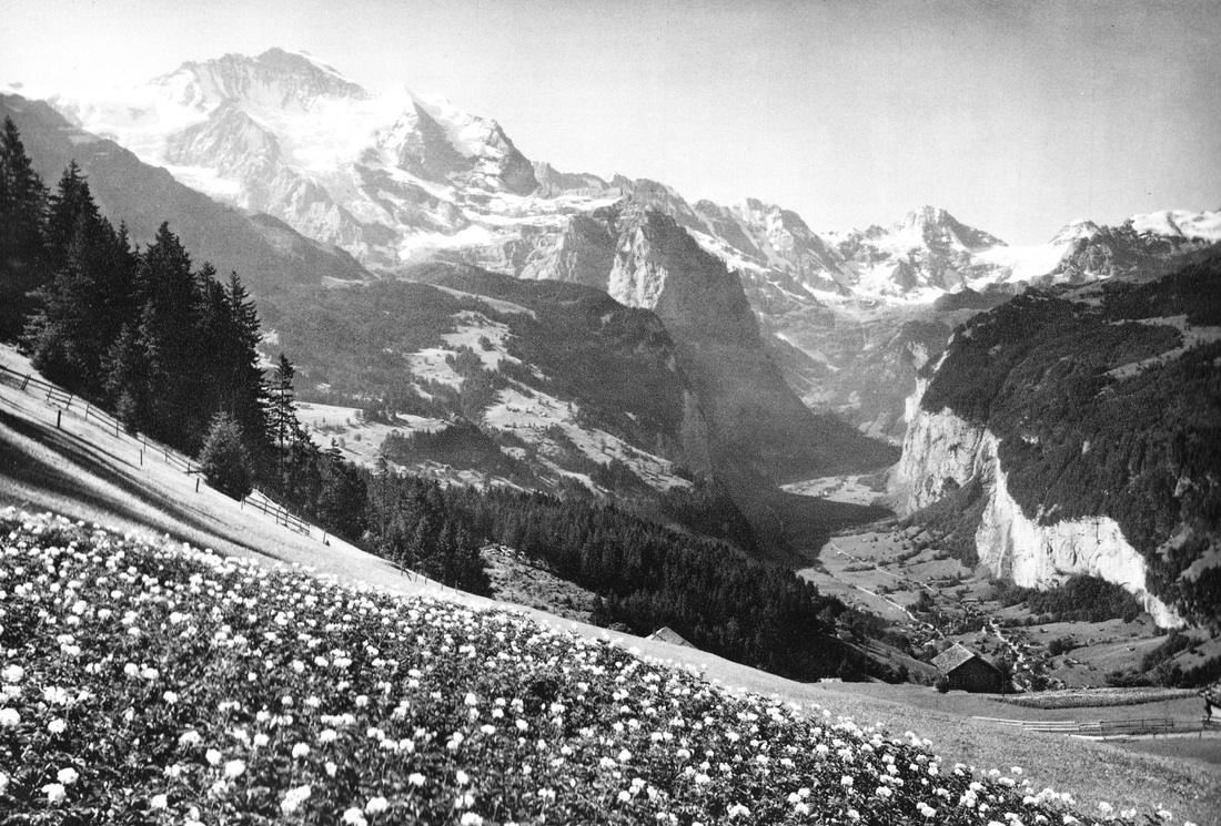
(R) Lauterbrunnen Valley and Wengen Mountain 1274 metres (4180 ft)
(R) Lauterbrunnen Valley and Wengen Mountain 1274 metres (4180 ft)
|
|
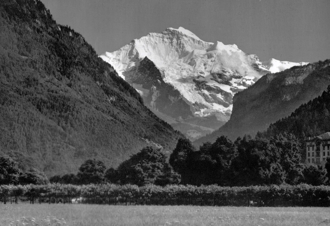
(L)Interlaken and the Jungfrau
(R)Niederhorn-Beatenberg 1065 metres ( 6446 ft) in the Jungfrau region
(R)Niederhorn-Beatenberg 1065 metres ( 6446 ft) in the Jungfrau region
