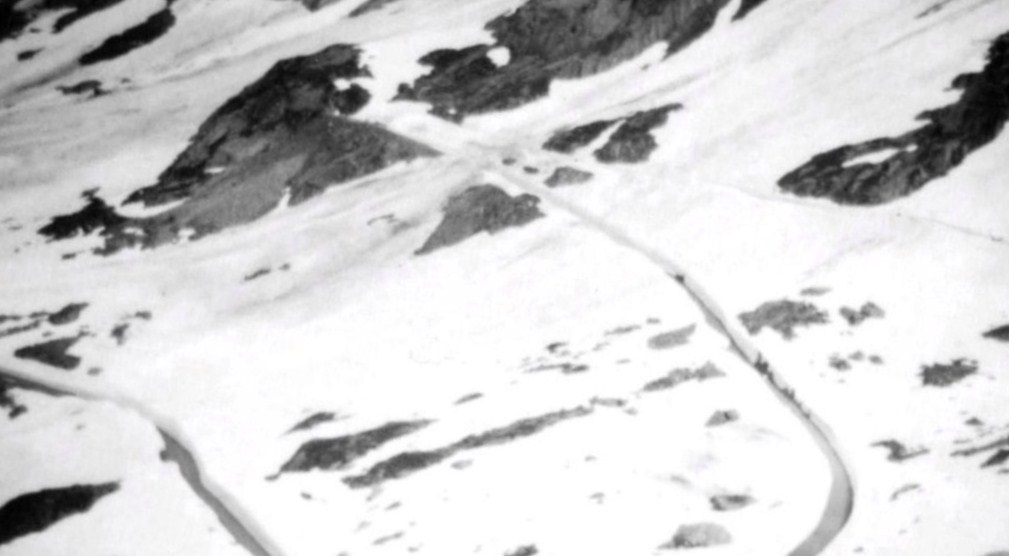
The Grimsel Pass, Switzerland. (29/5)
The high mountain pass is seen winding up the snow covered slopes. Traffic was being turned back near the top of the pass when this photo was taken. The road was blocked by snow and there was the possibility of an avalanche. Grimsel Pass reaches an elevation of 2165 metres.
It is located near the source of the Rhone River at the Rhone Glacier.
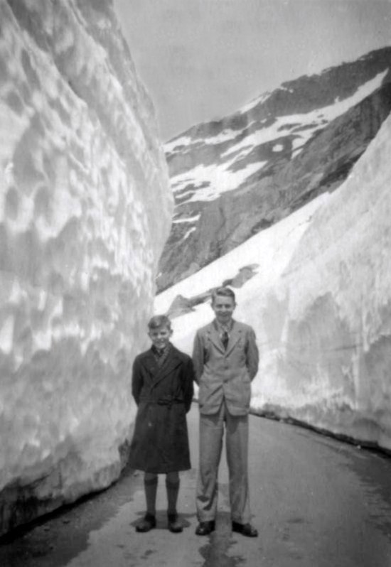
On the Grimsel Pass, Switzerland. (29/5) Snow-ploughs have cleared the roadway. The icy snow on the road towers over Keith (L) and Alan Wickenton. It's 6metres to 9 metres (20 to 30 feet) deep.
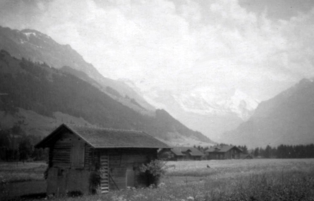
A view near Frutigen, Switzerland. (28/5)
Thick grass and wildflowers are shown growing in the area which has been settled since the Bronze Age. Small farms stretch from the valley floor up the mountain sides to 1,600 m (5,200 ft) above sea level. The snow-capped Jungfrau group of mountains is in the distance.
Thick grass and wildflowers are shown growing in the area which has been settled since the Bronze Age. Small farms stretch from the valley floor up the mountain sides to 1,600 m (5,200 ft) above sea level. The snow-capped Jungfrau group of mountains is in the distance.
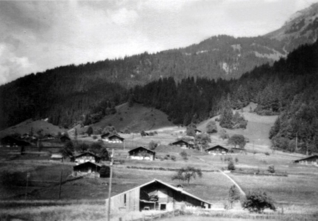
Switzerland.(28/5)
Chalets in a valley near Frutigen,
Chalets in a valley near Frutigen,
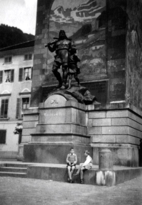
Altdorf on Lake Uri, Switzerland. (25/5) Two local boys sitting at the foot of an impressive statue of the Swiss folk hero, William Tell and his son Walter.
Tell supposedly split an apple on Walter’s head with an arrow from his crossbow in 1307, at this very spot in Altdorf.
The statue was erected in 1895.
Tell supposedly split an apple on Walter’s head with an arrow from his crossbow in 1307, at this very spot in Altdorf.
The statue was erected in 1895.
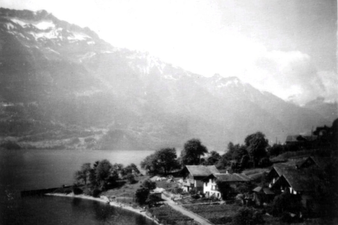
Oberried village, Switzerland. (26/5)
It is beautifully situated on the shore of Lake Brienz.(Brienzersee).
There have been passenger ships on the lake since 1839. The ships are now operated by the local railway company. There are five passenger ships on the lake at present (2012)
It is beautifully situated on the shore of Lake Brienz.(Brienzersee).
There have been passenger ships on the lake since 1839. The ships are now operated by the local railway company. There are five passenger ships on the lake at present (2012)
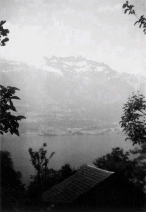
Photo from high up on a hill above the village of Oberried, Switzerland, showing Lake Brienz and mountains behind. (26/5)
The shores are steep, and there is almost no shallow water in the entire lake. Its reaches a depth is 260 meters (853ft).
Lake Brienze is about 14 kilometers (8.6 miles) long, 2.8 kilometers (1.7 miles) wide , and its area is 29.8 square kilometers (7,364 acres) . The lake surface is 564 metres (1,850 ft) above sea-level.
.
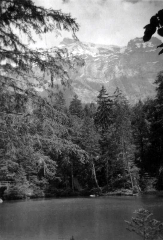
Blausee, near Frutigen, Switzerland. (28/5)
Blausee (Translated as Blue Lake) is a beautiful small lake in the valley of the Kander River , Switzerland, overlooked by snow-capped mountains.
The surface of the lake is at an elevation of 887m (2,900 ft) and covers an area of just 0.64 ha.(1.6 acres).
Located in the midst of a 20 ha (50 acre) nature park, Blausee is sourced from subterranean springs, and its clear blue water gets its colour from an interaction of minerals from the local flora and geology.
A large rock slide led to the creation of the lake, which has a maximum depth of 10 m (33 ft).
When this photo was taken, the lake was being used as a trout farm. An (organic) trout farm is still in operation (2012).
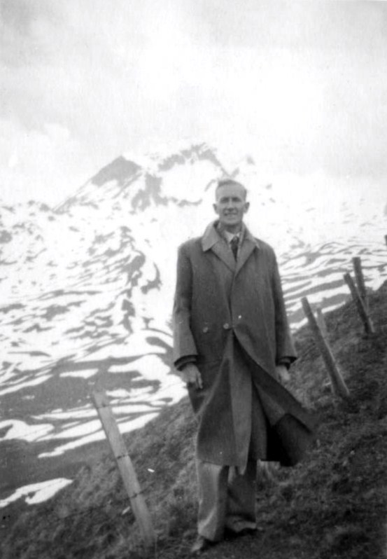
In the snow at First, Switzerland. (27/5)
The small settlement is at an elevation of 652 metres (2139ft.)
Arthur Shannon is wearing the protective gear provided by the operators of a chairlift which takes visitors up the mountain.
In the background of the photo is Eiger Mountain The north face of the Eiger – one of the most spectacular and difficult mountain faces to climb in the world – was successfully climbed for the first time only in 1938.
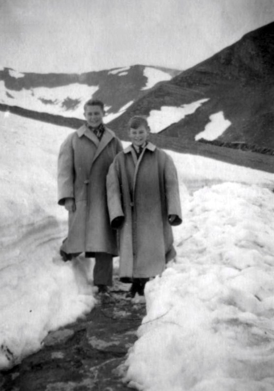
In the snow near the village of First, Switzerland. (27/5)
"One size fits all" is obviously the motto for the chairlift operators who carry visitors up to the small mountain settlement. This photo of Alan Wickenton (L) and Keith Wickenton was taken near Bergstation chair lift, Forst. The area around the village offers over 100 km (60miles) of hiking trails as well as 50 km (30Miles)of ski pistes and a toboggan run.
"One size fits all" is obviously the motto for the chairlift operators who carry visitors up to the small mountain settlement. This photo of Alan Wickenton (L) and Keith Wickenton was taken near Bergstation chair lift, Forst. The area around the village offers over 100 km (60miles) of hiking trails as well as 50 km (30Miles)of ski pistes and a toboggan run.
